Low Hill, Wolverhampton
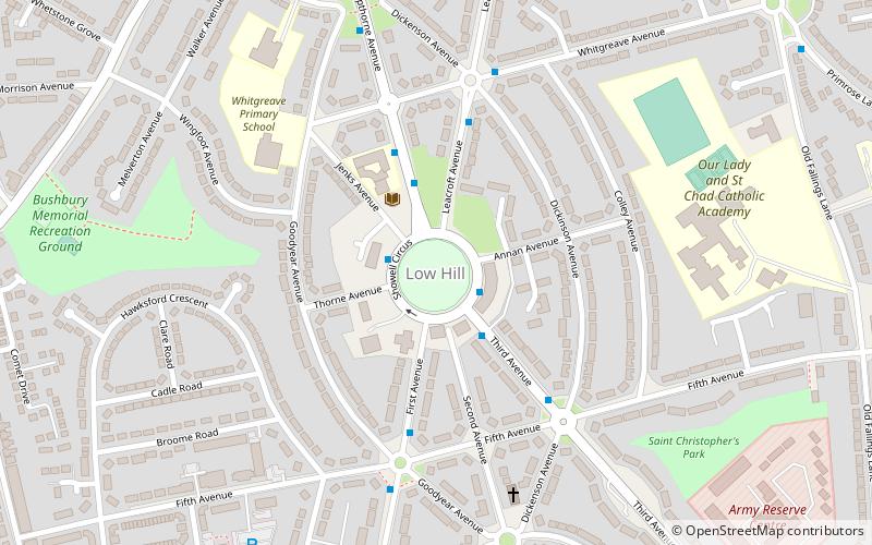
Map
Facts and practical information
Low Hill is in Wolverhampton, West Midlands, England. It is north-east of Wolverhampton city centre, within the Bushbury South and Low Hill ward. ()
Coordinates: 52°36'38"N, 2°6'49"W
Address
Bushbury South and Low HillWolverhampton
ContactAdd
Social media
Add
Getting there by public transportation
Public transportation stops near this location
- Bus
 Bus
Bus
- Calculate routeShowell Circus / Third Avenue 2 min walk
- Calculate routeKempthorne Ave / Whitgreave Avenue 3 min walk
- Calculate routeThird Ave / Sowell Circus 3 min walk
Day trips

Frequently Asked Questions (FAQ)
Which popular attractions are close to Low Hill?
Nearby attractions include Scotlands Estate, Wolverhampton (17 min walk), Stafford Road F.C., Wolverhampton (24 min walk).
How to get to Low Hill by public transport?
The nearest stations to Low Hill:
Bus
Bus
- Showell Circus / Third Avenue • Lines: 2, 25, 794 (2 min walk)
- Kempthorne Ave / Whitgreave Avenue • Lines: 2, 25, 794 (3 min walk)