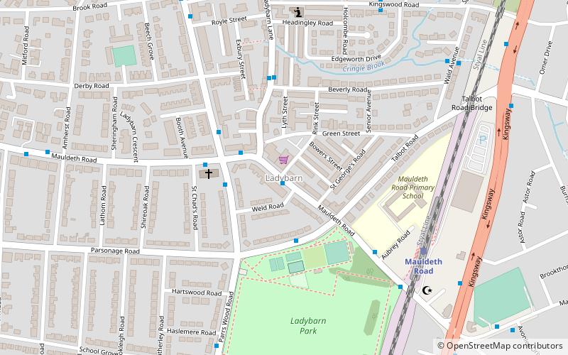
Ladybarn, Manchester
Map
Facts and practical information
Ladybarn is a small suburban area in Manchester, England, around Ladybarn Lane. It is now part of Manchester's urban sprawl but some of the village's original cobbled streets remain. The oldest properties are probably Rose Cottages, dating from the late 18th century. ()
Coordinates: 53°26'6"N, 2°12'47"W
Address
WithingtonManchester
ContactAdd
Social media
Add
Getting there by public transportation
Public transportation stops near this location
- Bus
- Tram
- Train
 Bus
Bus
- Calculate routeLadybarn, Mauldeth Road / at Ladybarn Village 1 min walk
- Calculate routeLadybarn, Mauldeth Road / near Ladybarn Lane 2 min walk
- Calculate routeLadybarn, Parrs Wood Road / adjacent Mauldeth Road 2 min walk
- Calculate routeMauldeth Road 5 min walk
- Calculate routeBurnage 23 min walk
- Calculate routeLevenshulme 28 min walk
- Calculate routeWest Didsbury 31 min walk
- Calculate routeBurton Road 31 min walk
Maps MetrolinkMaps
 Metrolink / Rail
MetrolinkMapsMetrolink / RailDay trips


Frequently Asked Questions (FAQ)
Which popular attractions are close to Ladybarn?
Nearby attractions include St Margaret's Church, Manchester (15 min walk), South Manchester Synagogue, Manchester (16 min walk), Wilmslow Road bus corridor, Manchester (18 min walk), Wilmslow Road, Manchester (18 min walk).
How to get to Ladybarn by public transport?
The nearest stations to Ladybarn:
Bus
Train
Tram
Bus
- Ladybarn, Mauldeth Road / at Ladybarn Village • Lines: 25 (1 min walk)
- Ladybarn, Mauldeth Road / near Ladybarn Lane • Lines: 171, 25 (2 min walk)
Train
- Mauldeth Road (5 min walk)
- Burnage (23 min walk)
Tram
- West Didsbury • Lines: EDid, Roch, Shaw (31 min walk)
- Burton Road • Lines: EDid, Roch, Shaw (31 min walk)