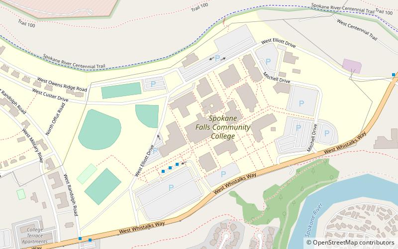
Spokane Falls Community College, Spokane
Map
Facts and practical information
Spokane Falls Community College is a public community college in Spokane, Washington. It was established in 1967 and is part of the Community Colleges of Spokane. ()
Established: 1967 (59 years ago)Coordinates: 47°40'35"N, 117°27'54"W
Getting there by public transportation
Public transportation stops near this location
- Bus
 Bus
Bus
- Calculate routeSFCC Station Bay 2 3 min walk
- Calculate routeFort George Wright @ Randolph 9 min walk
- Calculate routeGovernment Way @ N1202 18 min walk
Day trips


Frequently Asked Questions (FAQ)
How to get to Spokane Falls Community College by public transport?
The nearest stations to Spokane Falls Community College:
Bus
Bus
- SFCC Station Bay 2 • Lines: 20 (3 min walk)
- Fort George Wright @ Randolph • Lines: 20 (9 min walk)