Trek Zone

Signal Hills, Saint Paul

#190 among attractions in Saint Paul

Shopping, Shopping centre
Signal Hills

Facts and practical information

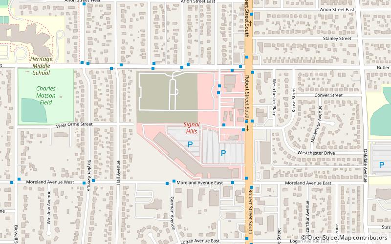
Signal Hills (address: 100 Signal Hills Ctr) is a place located in Saint Paul (Minnesota state) and belongs to the category of shopping, shopping centre.

It is situated at an altitude of 997 feet, and its geographical coordinates are 44°54'39"N latitude and 93°4'59"W longitude.

Among other places and attractions worth visiting in the area are: Thompson Oaks Golf Course (golf, 22 min walk), River to River Greenway (hiking, 31 min walk), Rau/Strong House (neo-renaissance architecture, 33 min walk).

Coordinates: 44°54'39"N, 93°4'59"W
Address

100 Signal Hills CtrWest St. PaulSaint Paul United States

ContactAdd
Social media
Add

Saint Paul plan & book

Unleash the traveler in you — discover the cheapest flight deals, find the perfect hotel or hostel nearby, and search for the best car rental prices. Travel at your own pace to discover new places and enjoy your journey.

Day trips

Signal Hills – popular in the area (distance from the attraction)

Nearby attractions include: Science Museum of Minnesota, Harriet Island Regional Park, Wabasha Street Caves, High Bridge.

  • science museum of minnesota saint paul2.3 miN
  • harriet island regional park saint paul1.9 miNW
  • wabasha street caves saint paul1.7 miN
  • high bridge saint paul1.8 miNW
  • minnesota centennial showboat saint paul2.1 miN
  • saint paul municipal grain terminal2.1 miNW
  • wabasha street bridge saint paul2.2 miN
  • pickerel lake saint paul location map
    1.9 miW
  • raspberry island saint paul2.2 miN
  • st paul union pacific rail bridge saint paul1.8 miE
  • omaha road bridge number 15 saint paul1.9 miNW

Where to next? Visit minnesota Minnesota region page or discover the top tourist attractions in United States.