Olympic National Park: Mountain
Places and attractions in the Mountain category
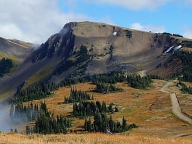
Obstruction Peak
Obstruction Peak is a 6,450 feet summit in the Olympic Mountains and is located in Clallam County of Washington state. It is set within Olympic National Park and is situated at the eastern end of Obstruction Point Road which is a narrow eight mile dirt road on Hurricane Ridge.
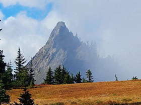
Steeple Rock
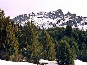
Steeple Rock is a 200 feet basalt pillar in the Olympic Mountains, and is located in Clallam County of Washington state. It sets next to the Obstruction Point Road on Hurricane Ridge within Olympic National Park.
Mount Queets
Mount Queets is a 6,476-foot mountain summit located deep within Olympic National Park in Jefferson County of Washington state. With a good eye and clear weather, the top of the mountain can be seen from the visitor center at Hurricane Ridge. Its nearest higher peak is Mount Meany, 0.8 mi to the south.
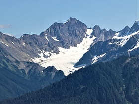
Mount Mathias
Mount Mathias is a 7,156-foot mountain summit located within Olympic National Park in Jefferson County of Washington state. Its nearest higher neighbor is Mount Olympus, 1.76 mi to the east. Mount Mathias is wedged between the massive Blue Glacier below its west slope, and the Hoh Glacier on the east side.
Mount Claywood
Mount Claywood is a 6,836-foot mountain summit located within Olympic National Park in Jefferson County of Washington state. It is situated at the head of Lost River, and 15 mi east of Mount Olympus. Its nearest higher neighbor is Mount Cameron, 2.4 mi to the northeast.
Mount Fairchild
Mount Fairchild, also known as Mount William Fairchild, is a 6,900-foot glaciated mountain summit located within Olympic National Park in Clallam County of Washington state. Mt.
Mount Appleton
Mount Appleton is a 6,000+ ft double summit mountain located in the Olympic Mountains, in Clallam County of Washington state. It is set within Olympic National Park and is situated northwest of Appleton Pass.
Mount Carrie
Mount Carrie is a 6,995-foot mountain summit located within Olympic National Park in Clallam County of Washington state. Mt. Carrie is the highest point in the Bailey Range which is a subrange of the Olympic Mountains.
Mount Meany
Mount Meany is a prominent 6,695-foot mountain summit located deep within Olympic National Park in Jefferson County of Washington state. With a good eye and clear weather, the top of the mountain can be seen from the visitor center at Hurricane Ridge.
Mount Fitzhenry
Mount Fitzhenry is a 6,050-foot mountain summit located within Olympic National Park in Clallam County of Washington state. Mt. Fitzhenry is in the Bailey Range, which is a subrange of the Olympic Mountains. In clear weather, the mountain can be seen from the visitor center at Hurricane Ridge.
Stephen Peak
Stephen Peak is a 6,418-foot mountain summit located within Olympic National Park in Jefferson County of Washington state. Stephen Peak is the fifth-highest peak in the Bailey Range, which is a subrange of the Olympic Mountains.
Mount Olympus
Highest peak in the Olympic Mountains Mount Olympus, at 7,980 feet, is the tallest and most prominent mountain in the Olympic Mountains of western Washington state. Located on the Olympic Peninsula, it is also the central feature of Olympic National Park.
Mount Ferry
Mount Ferry is a 6,195-foot mountain summit located within Olympic National Park in Jefferson County of Washington state. Mount Ferry is the eighth-highest peak in the Bailey Range, which is a subrange of the Olympic Mountains. In clear weather, the mountain can be seen from the visitor center at Hurricane Ridge.
Rocky Peak
Rocky Peak is a 6,218 feet summit in the Olympic Mountains and is located in Clallam County of Washington state. It is situated eight miles south of Port Angeles, Washington within Olympic National Park.
Muncaster Mountain
Muncaster Mountain is a 5,910-foot mountain summit located within Olympic National Park in Jefferson County of Washington state. It is situated 4.4 mi south-southeast of Mount Christie, and 14.6 mi southeast of Mount Olympus. Precipitation runoff from the mountain drains into Rustler Creek, which is a tributary of the Quinault River.
Mount Deception
Mount Deception is a peak in the Olympic Mountains of Cascadia. It is in Olympic National Park on the Olympic Peninsula in the U.S. state of Washington.
Pyramid Mountain
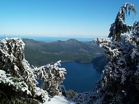
Pyramid Mountain is located high above Lake Crescent's north shore. Once known as Sugarloaf Mountain, it received its present name in 1928. It contains the ruins of an old fire lookout at the summit. It dominates the view from Barnes Point and Lake Crescent Lodge. It is accessible by trail from the Spruce Railroad Trail.
Mount Constance
Mount Constance is a peak in the Olympic Mountains of Washington and the third highest in the range. It is the most visually prominent peak on Seattle's western skyline.
Mount Pulitzer
Mount Pulitzer, also known as Snagtooth, is a 6,283-foot mountain summit located within Olympic National Park in Jefferson County of Washington state. Mount Pulitzer is the sixth-highest peak in the Bailey Range, which is a subrange of the Olympic Mountains.
Mount Angeles
Mount Angeles is located just south of Port Angeles, Washington in the Olympic National Park. It is the highest peak in the Hurricane Ridge area.
Bogachiel Peak
Bogachiel Peak is a 5,478-foot peak in the Olympic Mountains of Washington, U.S. It is located in Olympic National Park. It is a high point on High Divide, and forms the southern end of Seven Lakes Basin.
Olympic Mountains
The Olympic Mountains are a mountain range on the Olympic Peninsula of the Pacific Northwest of the United States.
Mount Anderson
Mount Anderson is a 7,330-foot-high peak in the Olympic Mountains of the Pacific Northwest. Rising in the center of Olympic National Park in Washington state, it is the second highest peak on the Anderson Massif, after West Peak.
Woden - The Valhallas
Woden is a 6,038-foot mountain summit located within Olympic National Park in Jefferson County of Washington state. Its nearest higher neighbor is Mount Tom, 3 mi to the north-northwest, and Mount Olympus rises 3.8 mi to the north-northeast. Woden is the highest point in The Valhallas, a sub-range south of Mount Olympus.
Ruth Peak
Ruth Peak is a 6,850+ ft glaciated mountain summit located within Olympic National Park in Clallam County of Washington state. Ruth Peak is the third-highest peak in the Bailey Range, which is a subrange of the Olympic Mountains. Its nearest higher neighbor is Mount Carrie, 0.91...
Aurora Peak
Aurora Peak is a summit in Olympic National Park in Clallam County, Washington. It is the highest point on Aurora Ridge. The northern flank of the ridge forms a steep escarpment above Lake Crescent, while the southern flank towers above the Sol Duc River.
Mount Dana
Mount Dana is a 6,213 feet mountain summit in Jefferson County of Washington state. Set within Olympic National Park, it is part of the Bailey Range which is a subset of the Olympic Mountains.
Mount Christie
Mount Christie is high peak in the Olympic Mountains of Washington in Olympic National Park. Mount Christie is located in the Queets-Quinault group. Precipitation on Mt. Christie drains into the Elwha River on the north side, and into the Quinault River on the south side.
Mount Stone
Mount Stone is a 6,612-foot peak in the Olympic Mountains. It is the highest point in Mason County, Washington and exceeds 2,000 feet in prominence. Mount Stone can be reached via the North Hamma Hamma Road. Climbing Mount Stone involves a class 3 rock scramble. This can be done either as a day climb or an overnight trip.
Mount La Crosse
Mount La Crosse, is a 6,417-foot mountain summit in the Olympic Mountains and is located in Jefferson County of Washington state. It is situated in Olympic National Park and its nearest higher peak is Mount Elk Lick, 2.54 mi to the east. The Anderson massif lies 2.67 mi to the...
Aries
Aries is a 6,533-foot mountain summit located within Olympic National Park in Jefferson County of Washington state. Its neighbors include Mount Olympus, 2.46 mi to the west, Athena 1.7 mi to the southwest, and Mount Mathias 1.11 mi to the northwest.
Piro's Spire
Piro's Spire, is a 6,259-foot basalt pinnacle summit in the Olympic Mountains and is located in Jefferson County of Washington state. It is situated in Olympic National Park and its nearest higher peak is Diamond Mountain, 1.86 miles to the west.
Boulder Peak
Boulder Peak is a peak located in Washington state, in Olympic National Park. The mountain is accessible by using the Olympic Hot Springs Trail and the Appleton Pass trail.
Gray Wolf Ridge
Gray Wolf Ridge is a spur of the northeastern Olympic Mountains in Washington's Olympic Peninsula.
Mount Duckabush
Mount Duckabush is a 6,254-foot peak located in Olympic National Park in the Olympic Mountains of Washington state. The headwaters of the Duckabush River include the northwest slopes of Mount Duckabush.
Map

