Bruckner Interchange, New York City
Map

Map

Facts and practical information
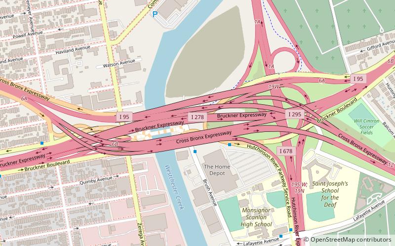
The Bruckner Interchange is a complex interchange in the New York City borough of The Bronx in the United States. The junction connects four highways: the Bruckner, Cross Bronx, and Hutchinson River Expressways, and the Hutchinson River Parkway. It was constructed in the 1960s; however, elements of the junction date as far back as the 1940s. The interchange includes connections to several interstate routes, including I-278, I-678, I-295 and I-95. ()
Coordinates: 40°49'43"N, 73°50'27"W
Address
East Bronx (Throgs Neck)New York City
ContactAdd
Social media
Add
Day trips
Bruckner Interchange – popular in the area (distance from the attraction)
Nearby attractions include: Ferry Point Park, St. Raymond's Church, St. Helena's Church, Saint John Vianney Roman Catholic Church.
Frequently Asked Questions (FAQ)
Which popular attractions are close to Bruckner Interchange?
Nearby attractions include Saint Raymond's Cemetery, New York City (11 min walk), Saint John Vianney Roman Catholic Church, New York City (18 min walk), Huntington Free Library and Reading Room, New York City (21 min walk), St. Helena's Church, New York City (22 min walk).
How to get to Bruckner Interchange by public transport?
The nearest stations to Bruckner Interchange:
Metro
Bus
Metro
- Zerega Avenue • Lines: <6>, 6 (17 min walk)
- Castle Hill Avenue • Lines: <6>, 6 (18 min walk)
Bus
- Randall Avenue & East Tremont Avenue • Lines: Bx42 (26 min walk)
- East Tremont Avenue & Dogwood Drive • Lines: Bx40, Bx42 (36 min walk)

 Subway
 Manhattan Buses


