Pleasure Ridge Park, Louisville
Map
Facts and practical information
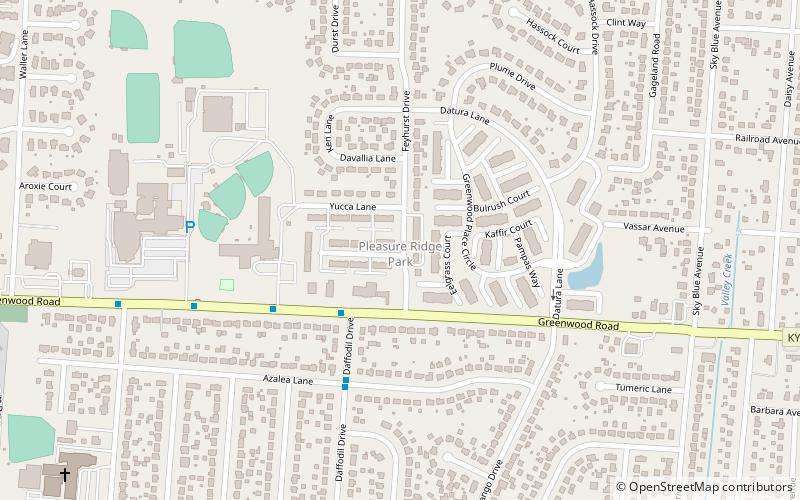
Pleasure Ridge Park is a former census-designated place in southwest Jefferson County, Kentucky, United States. The population was 26,212 at the 2010 census. In 2003, the area was annexed to the city of Louisville due to a merger between the city and Jefferson County's unincorporated communities. Pleasure Ridge Park is now said to be a neighborhood within the city limits of Louisville by local media. ()
Address
West Louisville (Pleasure Ridge Park)Louisville
ContactAdd
Social media
Add
Getting there by public transportation
Public transportation stops near this location
- Bus
 Bus
Bus
- Calculate routeGreenwood / Daffodil 3 min walk
- Calculate routeGreenwood / Yucca 5 min walk
- Calculate routeDaffodil / Azalea 5 min walk
Day trips


Frequently Asked Questions (FAQ)
How to get to Pleasure Ridge Park by public transport?
The nearest stations to Pleasure Ridge Park:
Bus
Bus
- Greenwood / Daffodil • Lines: 63South, 63South-alt (3 min walk)
- Greenwood / Yucca • Lines: 63North, 63North-alt (5 min walk)