St Helena, Baltimore
Map
Facts and practical information
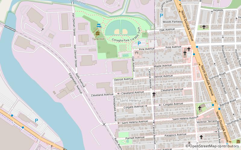
St Helena is the southeasternmost neighborhood in the city of Baltimore, Maryland. St. Helena is a neighborhood within the community of Dundalk. The Baltimore City/Baltimore County boundary line runs through St. Helena. So, St. Helena is located in both Baltimore County and Baltimore City. It has a mix of rowhouses and detached homes. It is divided by railroad tracks from the Point Breeze Industrial Park. ()
Coordinates: 39°15'45"N, 76°31'56"W
Address
Southeastern Baltimore (Saint Helena)Baltimore
ContactAdd
Social media
Add
Getting there by public transportation
Public transportation stops near this location
- Bus
 Bus
Bus
- Calculate routeDundalk Marine Terminal 11 min walk
- Calculate routeDundalk Avenue & Center Place Northbound Mid-block 16 min walk
- Calculate routeDundalk Loop & South Center Place 16 min walk
Day trips


Frequently Asked Questions (FAQ)
How to get to St Helena by public transport?
The nearest stations to St Helena:
Bus
Bus
- Dundalk Marine Terminal • Lines: 65 (11 min walk)
- Dundalk Avenue & Center Place Northbound Mid-block • Lines: 63 (16 min walk)