Jami Mosque, Toronto
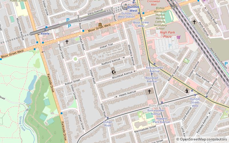
Map
Facts and practical information
Jami Mosque is a mosque in Toronto, Ontario, Canada. Located just east of High Park, it is the oldest Canadian Islamic centre in the city and dubbed "the mother of all the mosques in Toronto". ()
Established: 1968 (58 years ago)Coordinates: 43°39'12"N, 79°27'16"W
Getting there by public transportation
Public transportation stops near this location
- Metro
- Bus
- Tram
- Train
 Metro
Metro
- Calculate routeBoustead Avenue 4 min walk
- Calculate routeRoncesvalles Avenue 4 min walk
- Calculate routeIndian Road 5 min walk
- Calculate routeDundas West 8 min walk
- Calculate routeKeele 8 min walk
- Calculate routeHigh Park 16 min walk
- Calculate routeLansdowne 19 min walk
- Calculate routeBloor 10 min walk
- Calculate routeSymington Avenue 12 min walk
- Calculate routeBloor Street West 12 min walk
- Calculate route1388 Bloor Street West 13 min walk
- Calculate routePaton Road 14 min walk
Maps SubwayMaps
 Streetcar systemMaps
 PATH
PATH
SubwayMapsStreetcar systemMapsPATHDay trips


Frequently Asked Questions (FAQ)
Which popular attractions are close to Jami Mosque?
Nearby attractions include Olga Korper Gallery, Toronto (10 min walk), Church of St. Martin-in-the-Fields, Toronto (12 min walk), West Toronto Railpath, Toronto (12 min walk), Art Metropole, Toronto (13 min walk).
How to get to Jami Mosque by public transport?
The nearest stations to Jami Mosque:
Tram
Metro
Train
Bus
Tram
- Boustead Avenue • Lines: 504A (4 min walk)
- Roncesvalles Avenue • Lines: 306, 505 (4 min walk)
Metro
- Dundas West • Lines: 2 (8 min walk)
- Keele • Lines: 2 (8 min walk)
Train
- Bloor (10 min walk)
Bus
- Symington Avenue • Lines: 402 (12 min walk)
- Bloor Street West • Lines: 402 (12 min walk)