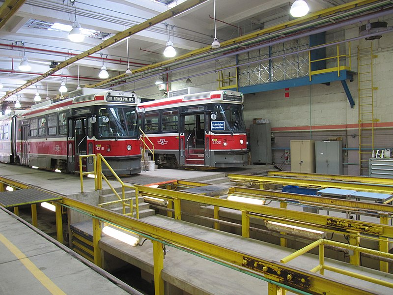
Roncesvalles Carhouse, Toronto

Gallery (2)
Map
Map
Gallery
Facts and practical information
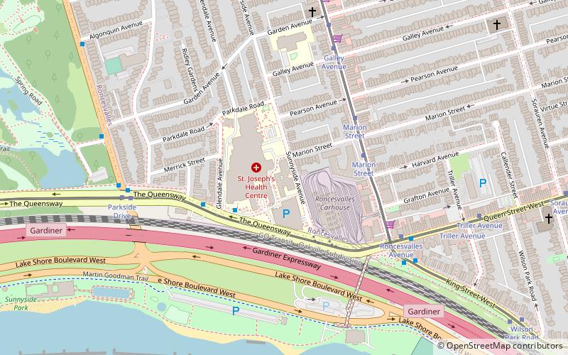
The Roncesvalles Carhouse is a storage and maintenance facility for the streetcar network of the Toronto Transit Commission. Located at the northwest corner of The Queensway and Roncesvalles Avenue in Toronto, Ontario, west of its downtown core, it is the oldest of the TTC's three active carhouses. The carhouse serves vehicles on routes 501 Queen, 504 King, 505 Dundas, 506 Carlton, 511 Bathurst, and 512 St. Clair. ()
Coordinates: 43°38'25"N, 79°26'57"W
Address
20 The QueenswayWest End (Roncesvalles Village)Toronto
ContactAdd
Social media
Add
Getting there by public transportation
Public transportation stops near this location
- Metro
- Bus
- Tram
 Metro
Metro
- Calculate route30 The Queensway 3 min walk
- Calculate routeRoncesvalles Avenue 6 min walk
- Calculate routeTriller Avenue 8 min walk
- Calculate routeBeaty Avenue 11 min walk
- Calculate routeMarion Street 4 min walk
- Calculate routeRoncesvalles Avenue 6 min walk
- Calculate routeGalley Avenue 6 min walk
- Calculate routeGarden Avenue 7 min walk
- Calculate routeKeele 31 min walk
- Calculate routeDundas West 31 min walk
- Calculate routeHigh Park 33 min walk
Maps SubwayMaps
 Streetcar systemMaps
 PATH
PATH
SubwayMapsStreetcar systemMapsPATHDay trips


Frequently Asked Questions (FAQ)
Which popular attractions are close to Roncesvalles Carhouse?
Nearby attractions include Sunnyside, Toronto (10 min walk), Roncesvalles, Toronto (11 min walk), Sunnyside Bathing Pavilion, Toronto (12 min walk), St. Vincent de Paul Roman Catholic Church, Toronto (13 min walk).
How to get to Roncesvalles Carhouse by public transport?
The nearest stations to Roncesvalles Carhouse:
Bus
Tram
Metro
Bus
- 30 The Queensway • Lines: 402 (3 min walk)
- Roncesvalles Avenue • Lines: 402 (6 min walk)
Tram
- Marion Street • Lines: 504A (4 min walk)
- Roncesvalles Avenue • Lines: 501, 501;301 (6 min walk)
Metro
- Keele • Lines: 2 (31 min walk)
- Dundas West • Lines: 2 (31 min walk)