Sullivan Heights, Burnaby
Map
Facts and practical information
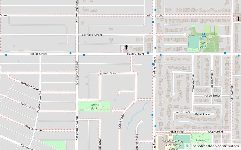
Sullivan Heights is a neighbourhood in Burnaby, just north of Lougheed highway, east of Government road and south of SFU campus. Bordering the city of Coquitlam and Port Moody, the area is served by the newly operational Millennium Line that connects the city of Coquitlam to other parts of greater Vancouver. ()
Coordinates: 49°16'1"N, 122°58'1"W
Address
Sperling-BroadwayBurnaby
ContactAdd
Social media
Add
Getting there by public transportation
Public transportation stops near this location
- Metro
- Bus
 Metro
Metro
- Calculate routeSperling Ave at Halifax St 4 min walk
- Calculate routeHalifax St at Sperling Ave 4 min walk
- Calculate routeSperling–Burnaby Lake 15 min walk
- Calculate routeHoldom 18 min walk
Day trips


Frequently Asked Questions (FAQ)
Which popular attractions are close to Sullivan Heights?
Nearby attractions include Montecito, Burnaby (17 min walk), Parkcrest, Burnaby (17 min walk), North Burnaby, Burnaby (19 min walk), Kensington Park, Burnaby (22 min walk).
How to get to Sullivan Heights by public transport?
The nearest stations to Sullivan Heights:
Bus
Metro
Bus
- Sperling Ave at Halifax St • Lines: 134 (4 min walk)
- Halifax St at Sperling Ave • Lines: 136 (4 min walk)
Metro
- Sperling–Burnaby Lake • Lines: Millennium Line (15 min walk)
- Holdom • Lines: Millennium Line (18 min walk)