Dronning Olgas Vej, Copenhagen

Gallery (2)
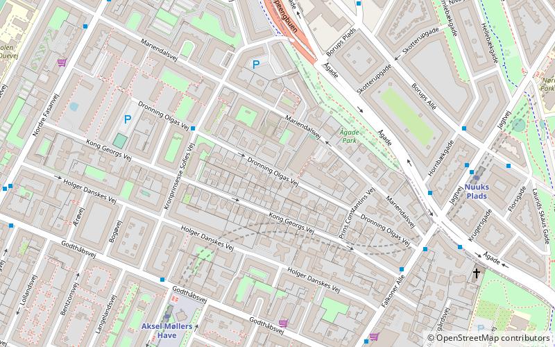
Map
Map
Gallery
Facts and practical information
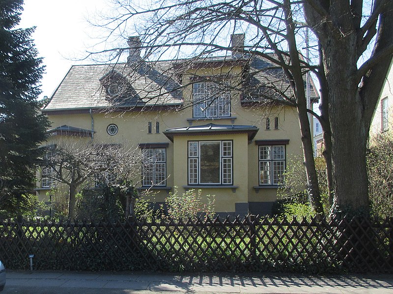
Dronning Olgas Vej is a street in the Mariendal neighborhood of Frederiksberg in Copenhagen, Denmark. It runs from Falkoner Allé in the east to a modernist housing estate adjacent to Nordre Fasanvej in the west from where it turns south to join King Georgs Vej. The Modernist housing estate was built in the 1970s in the former grounds of the Stjernen cooperative brewery. Most of the other buildings in the street are single family detached homes from the late 19th and early 20th century. ()
Coordinates: 55°41'19"N, 12°32'11"E
Address
FrederiksbergCopenhagen
ContactAdd
Social media
Add
Getting there by public transportation
Public transportation stops near this location
- Metro
- Bus
- Light rail
- Train
 Metro
Metro
- Calculate routeJagtvej 5 min walk
- Calculate routeAksel Møllers Have St. 5 min walk
- Calculate routeÅgade 5 min walk
- Calculate routeBorups Plads 6 min walk
- Calculate routeAksel Møllers Have 6 min walk
- Calculate routeNuuks Plads 7 min walk
- Calculate routeFrederiksberg 14 min walk
- Calculate routeNørrebros Runddel 16 min walk
- Calculate routeVesterport 34 min walk
- Calculate routeCopenhagen Central Station 41 min walk
- Calculate routeCopenhagen Central Station 41 min walk
Maps Metro
Metro
MetroDay trips


Frequently Asked Questions (FAQ)
Which popular attractions are close to Dronning Olgas Vej?
Nearby attractions include Aksel Møllers Have, Copenhagen (5 min walk), Mariendalsvej, Copenhagen (7 min walk), Mariendal Church, Copenhagen (7 min walk), De Døves Kirke, Copenhagen (7 min walk).
How to get to Dronning Olgas Vej by public transport?
The nearest stations to Dronning Olgas Vej:
Bus
Metro
Light rail
Train
Bus
- Jagtvej • Lines: 250S (5 min walk)
- Aksel Møllers Have St. • Lines: 2A (5 min walk)
Metro
- Aksel Møllers Have • Lines: M3 (6 min walk)
- Nuuks Plads • Lines: M3 (7 min walk)
Light rail
- Vesterport • Lines: A, B, Bx, C, E, H (34 min walk)
- Copenhagen Central Station • Lines: A, B, Bx, C, E, H (41 min walk)
Train
- Copenhagen Central Station (41 min walk)