Mariendalsvej, Copenhagen

Gallery (3)
Map
Map
Gallery
Facts and practical information
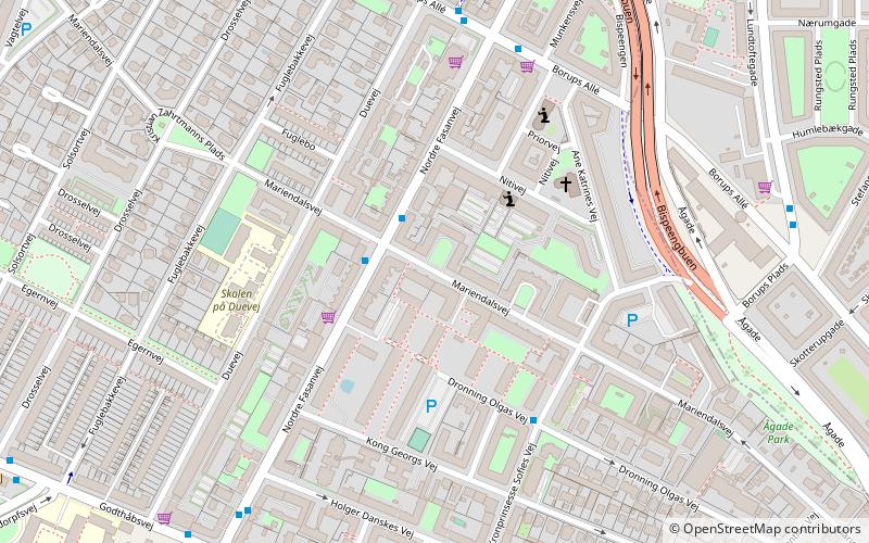
Mariendalsvej is a street in the Frederiksberg district of Copenhagen, Denmark. It runs from Falkoner Allé in the southeast to the Ring Line in the northwest. The area to the southeast of Nordre Fasanvej runs through the Mariendal Quarter and the rest runs through the Fuglebakken neighbourhood. ()
Address
FrederiksbergCopenhagen
ContactAdd
Social media
Add
Getting there by public transportation
Public transportation stops near this location
- Metro
- Bus
- Light rail
 Metro
Metro
- Calculate routeMariendalsvej 2 min walk
- Calculate routeNordre Fasanvej 6 min walk
- Calculate routeBorups Allé 6 min walk
- Calculate routeGodthåbsvej 6 min walk
- Calculate routeAksel Møllers Have 9 min walk
- Calculate routeNuuks Plads 12 min walk
- Calculate routeNørrebros Runddel 18 min walk
- Calculate routeBispebjerg 29 min walk
- Calculate routePeter Bangs Vej 37 min walk
Maps Metro
Metro
MetroDay trips


Frequently Asked Questions (FAQ)
Which popular attractions are close to Mariendalsvej?
Nearby attractions include Mariendal Church, Copenhagen (4 min walk), Copenhagen Denmark Temple, Copenhagen (4 min walk), Borups Allé, Copenhagen (6 min walk), Fasanvej, Copenhagen (6 min walk).
How to get to Mariendalsvej by public transport?
The nearest stations to Mariendalsvej:
Bus
Metro
Light rail
Bus
- Mariendalsvej • Lines: 4A (2 min walk)
- Nordre Fasanvej • Lines: 12 (6 min walk)
Metro
- Aksel Møllers Have • Lines: M3 (9 min walk)
- Nuuks Plads • Lines: M3 (12 min walk)
Light rail
- Bispebjerg • Lines: F (29 min walk)
- Peter Bangs Vej • Lines: C (37 min walk)