Burg Zweiffel, Bergisch Gladbach
Map

Map

Facts and practical information
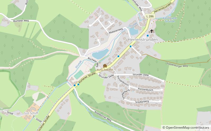
Burg Zweiffel is a former noble seat in the valley of the Strunde, about three kilometers northeast of the city center of Bergisch Gladbach in the district of Herrenstrunden.
Coordinates: 51°0'19"N, 7°10'40"E
Address
Bergisch Gladbach
ContactAdd
Social media
Add
Day trips
Burg Zweiffel – popular in the area (distance from the attraction)
Nearby attractions include: Altenberger Dom, Mediterana, Märchenwald Altenberg, Altenberg Abbey.
Frequently Asked Questions (FAQ)
How to get to Burg Zweiffel by public transport?
The nearest stations to Burg Zweiffel:
Bus
Bus
- Herrenstrunden • Lines: 404, 426 (3 min walk)
- Schiff • Lines: 426 (4 min walk)


