Sievekingplatz, Hamburg
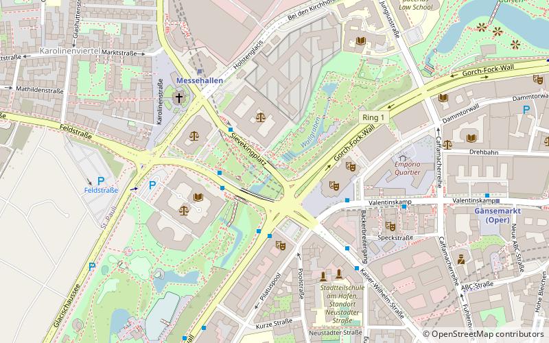
Map
Facts and practical information
Coordinates: 53°33'22"N, 9°58'45"E
Getting there by public transportation
Public transportation stops near this location
- Metro
- Bus
- Light rail
- Train
- Ferry
 Metro
Metro
- Calculate routeSievekingplatz 2 min walk
- Calculate routeJohannes-Brahms-Platz 3 min walk
- Calculate routeDragonerstall 4 min walk
- Calculate routeMessehallen 5 min walk
- Calculate routeGänsemarkt 8 min walk
- Calculate routeFeldstraße 11 min walk
- Calculate routeStephansplatz 12 min walk
- Calculate routeStadthausbrücke 14 min walk
- Calculate routeHamburg Dammtor / Universität 14 min walk
- Calculate routeJungfernstieg 17 min walk
- Calculate routeHamburg Dammtor / Universität 14 min walk
- Calculate routeHamburg Central Station 30 min walk
- Calculate routeJungfernstieg 16 min walk
- Calculate routeSt. Pauli-Landungsbrücken 25 min walk
- Calculate routeAtlantic 27 min walk
- Calculate routeRabenstraße 32 min walk
Day trips


Frequently Asked Questions (FAQ)
Which popular attractions are close to Sievekingplatz?
Nearby attractions include Laeiszhalle, Hamburg (3 min walk), Kellertheater Hamburg, Hamburg (3 min walk), Hamburg Temple, Hamburg (4 min walk), Scandic Hamburg Emporio, Hamburg (5 min walk).
How to get to Sievekingplatz by public transport?
The nearest stations to Sievekingplatz:
Bus
Metro
Light rail
Train
Ferry
Bus
- Sievekingplatz • Lines: 3, 602, X35 (2 min walk)
- Johannes-Brahms-Platz • Lines: 112, 3, 607, 688, X35 (3 min walk)
Metro
- Messehallen • Lines: U2 (5 min walk)
- Gänsemarkt • Lines: U2 (8 min walk)
Light rail
- Stadthausbrücke • Lines: S1, S2, S3 (14 min walk)
- Hamburg Dammtor / Universität • Lines: S11, S21, S31 (14 min walk)
Train
- Hamburg Dammtor / Universität (14 min walk)
- Hamburg Central Station (30 min walk)
Ferry
- Jungfernstieg • Lines: Alsterkreuzfahrt (16 min walk)
- St. Pauli-Landungsbrücken • Lines: FRS HanseFerry (25 min walk)