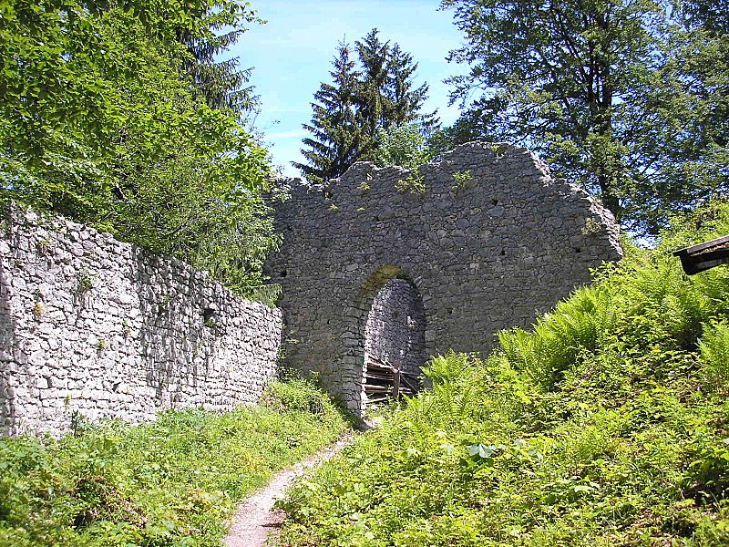
Werdenfels Castle, Garmisch-Partenkirchen

Gallery (4)
Map

Map
Gallery
Facts and practical information
The ruins of Werdenfels Castle stand about 80 metres above the Loisach valley between Garmisch and Farchant in the county of Garmisch-Partenkirchen in Upper Bavaria. The spur castle was used until 1632 as the administrative centre of the County of Werdenfels, but began to fall into disrepair thereafter. ()
Address
Garmisch-Partenkirchen
ContactAdd
Social media
Add
Getting there by public transportation
Public transportation stops near this location
- Bus
- Train
 Bus
Bus
- Calculate routeSchützenhaus 27 min walk
- Calculate routeWankbahn 28 min walk
- Calculate routeFarchant, Antoni-Stüberl 37 min walk
- Calculate routeFarchant 38 min walk
Day trips


Frequently Asked Questions (FAQ)
How to get to Werdenfels Castle by public transport?
The nearest stations to Werdenfels Castle:
Bus
Train
Bus
- Schützenhaus • Lines: 4, 5 (27 min walk)
- Wankbahn • Lines: 4, 5 (28 min walk)
Train
- Farchant (38 min walk)