Simonsberg
Map

Gallery

Facts and practical information
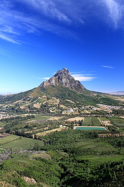
Simonsberg is part of the Cape Fold Belt in the Western Cape province of South Africa. It is located between the towns of Stellenbosch, Paarl and Franschhoek, forming a prominent 1399 m high mountain, as it is detached from the other ranges in the winelands region. Simonsberg is named after Simon van der Stel, first governor of the Cape and founder and namesake of Stellenbosch and Simon's Town. ()
Population: ~870 pplCoordinates: 54°26'12"N, 8°58'19"E
Location
Schleswig-Holstein
ContactAdd
Social media
Add
Day trips
Simonsberg – popular in the area (distance from the attraction)
Nearby attractions include: Husumer Speicher, Mary's Church, Altes Rathaus, Schloss vor Husum.


