Utzenfeld, Aitern
#1 among attractions in Aitern

Facts and practical information
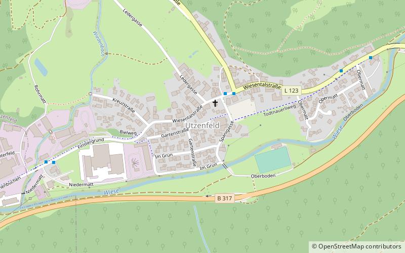
Utzenfeld is a town in the district of Lörrach in Baden-Württemberg in Germany. ()
Aitern plan & book
Unleash the traveler in you — discover the cheapest flight deals, find the perfect hotel or hostel nearby, and search for the best car rental prices. Travel at your own pace to discover new places and enjoy your journey.
Utzenfeld – popular in the area (distance from the attraction)
Nearby attractions include: Feldsee, Herzogenhorn, Belchen, Seebuck.
 Nature, Natural attraction, Lake
Feldsee
188 min walk • Nestled in the heart of the Black Forest, Feldsee is a serene lake in Germany that offers a picturesque escape into nature. This glacial lake, formed during the last Ice Age, is surrounded by steep hills and dense forests, creating a tranquil atmosphere for visitors...
 Nature, Natural attraction, Mountain
Herzogenhorn
138 min walk • Herzogenhorn, Germany, presents an impressive peak that beckons outdoor enthusiasts and nature lovers alike. Standing at an elevation of 1,415 meters, Herzogenhorn is the third highest mountain in the Black Forest, offering breathtaking views that span across rolling...
 Nature, Natural attraction, Mountain
Belchen
93 min walk • Nestled within the verdant landscapes of the Black Forest, Belchen stands as one of the most prominent mountains in the region of Baden-Württemberg, Germany. At an elevation of 1,414 meters, it is the third-highest peak in the Black Forest, offering breathtaking views...
 Nature, Natural attraction, Mountain
Seebuck
176 min walk • Nestled in the heart of the Black Forest, Seebuck is a mountain peak that offers breathtaking views and a wealth of outdoor activities. With an elevation of 1,448 meters, it is one of the prominent peaks in the Feldberg area, the highest mountain range in the state of...
 Nature, Natural attraction, Mountain
Hasenhorn, Todtnau
60 min walk • The Hasenhorn is a mountain, 1,155.6 m above sea level, in the Southern Black Forest in Germany. The mountain lies southeast of the little town of Todtnau.
 Hiking, Hiking trail
Alpine Path
138 min walk • Nestled in the picturesque landscapes of Germany, the Alpine Path beckons outdoor enthusiasts with its stunning vistas and invigorating trails. This hiking trail is a jewel in the crown of Germany's natural splendors, offering a chance to escape into the serenity of...
 Nature, Natural attraction, Mountain
Stübenwasen
135 min walk • Nestled in the heart of the Black Forest in Germany, Stübenwasen stands as a testament to the region's natural beauty. This mountain, rising to an elevation of 1,386 meters, is a favored destination for hikers and nature enthusiasts.
 Nature, Natural attraction, Mountain
Hochkopf
104 min walk • The Hochkopf is a wooded ridge north of the village of Todtmoos in the southern part of the High Black Forest. At 1,263.4 m above sea level its summit is one of the 20 highest points in the German state of Baden-Württemberg.
 Nature, Natural attraction, Mountain
Baldenweger Buck
179 min walk • The Baldenweger Buck is a mountain top, 1,460.5 m above sea level, in the Black Forest around 900 metres northeast of the Feldberg summit.
 Nature, Natural attraction, Mountain
Feldberg
178 min walk • At 1,493 metres the Feldberg in the Black Forest is the highest mountain in Baden-Württemberg, and the highest in Germany outside of the Alps. The local municipality of Feldberg was named after the mountain.
 Park
ParkSouthern Black Forest Nature Park
176 min walk • The Southern Black Forest Nature Park is located in Baden-Württemberg in Germany and covers an area of 394,000 hectares. As of 2018, it is Germany's largest nature park.


