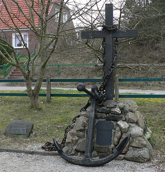
De Drinkeldodenkarkhof, Spiekeroog

Gallery (3)
Map
Map
Gallery
Facts and practical information
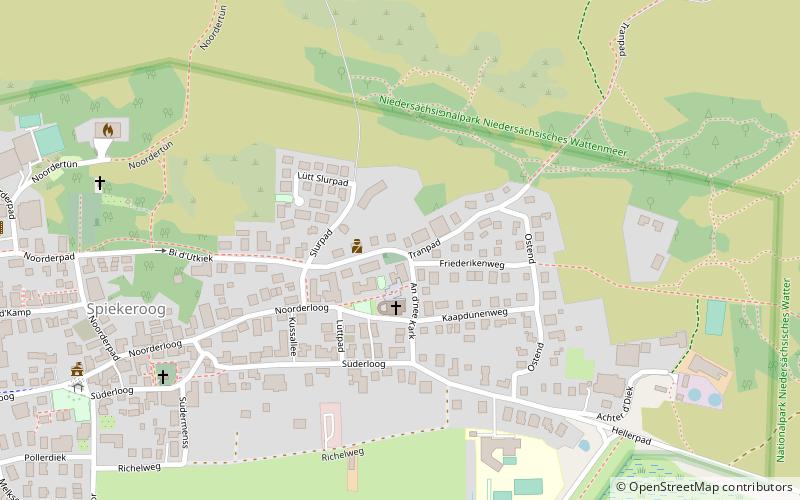
Drinkeldodenkarkhoff in Tranpad on Spiekeroog, also called Cemetery of the Homeless, is a memorial to the victims of the emigrant ship Johanne, which stranded off the island on November 6, 1854. As a result of the accident, 77 emigrants lost their lives. The recovered dead were buried on November 9 in a dune valley, which was still outside the village at that time. In the following years, bodies washed up on the beach were repeatedly buried there.
Coordinates: 53°46'18"N, 7°42'2"E
Address
Tranpad 4Spiekeroog 26474
ContactAdd
Social media
Add
Day trips


Frequently Asked Questions (FAQ)
Which popular attractions are close to De Drinkeldodenkarkhof?
Nearby attractions include Alte Inselkirche, Spiekeroog (7 min walk), Sankt Peter, Spiekeroog (15 min walk).