Christ-König-Kirche, Mannheim
Map

Map

Facts and practical information
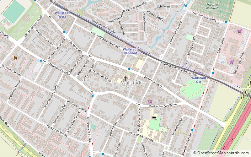
Christ the King Church is a Catholic church in the Wallstadt district of Mannheim. It was built between 1911 and 1914 according to the plans of Ludwig Maier.
Coordinates: 49°29'50"N, 8°32'55"E
Day trips
Christ-König-Kirche – popular in the area (distance from the attraction)
Nearby attractions include: SAP Arena, Carl-Benz-Stadion, Fernmeldeturm Mannheim, Luisenpark.
Frequently Asked Questions (FAQ)
How to get to Christ-König-Kirche by public transport?
The nearest stations to Christ-König-Kirche:
Bus
Train
Tram
Bus
- Wallstadtschule • Lines: 50, 57E (1 min walk)
- Wallstadt Mitte • Lines: 57, 57E (3 min walk)
Train
- Wallstadt Bahnhof (3 min walk)
- Wallstadt Ost (6 min walk)
Tram
- Kiesäcker • Lines: 7 (15 min walk)
- Hölderlinstraße • Lines: 7 (22 min walk)


