Doberg

Gallery (4)
Map

Map
Gallery
Facts and practical information
Doberg is the name of the following geographical objects: Doberg, district of the municipality of Hofamt Priel, district of Melk, Lower Austria.
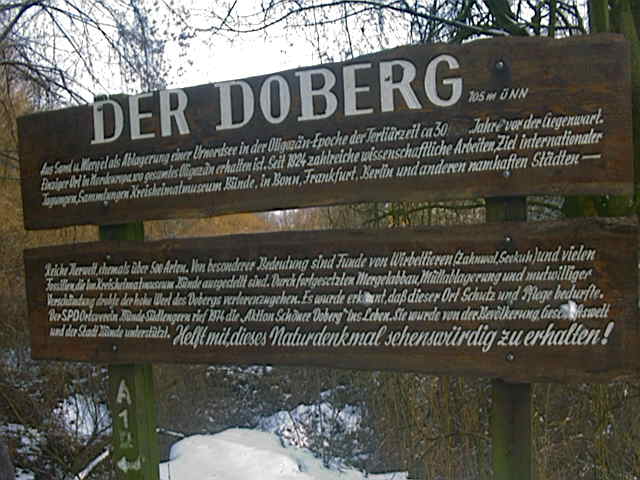
Doberg, area in Südlengern in the town of Bünde, East Westphalia, North Rhine-Westphalia
Coordinates: 52°11'3"N, 8°36'58"E
Location
North Rhine-Westphalia
ContactAdd
Social media
Add
Day trips


