City Hall, Mühlheim am Main
Map
Facts and practical information
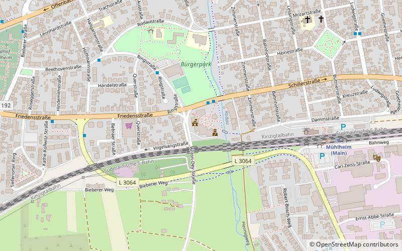
City Hall (address: Friedensstraße 20) is a place located in Mühlheim am Main (Hesse state) and belongs to the category of city hall.
It is situated at an altitude of 341 feet, and its geographical coordinates are 50°7'11"N latitude and 8°49'57"E longitude.
Among other places and attractions worth visiting in the area are: Friedensstraße (bridge, 2 min walk), Gerda's kleine Weltbühne (concerts and shows, 17 min walk), DLRG Maintal, Maintal (non-profit, 39 min walk).
Coordinates: 50°7'11"N, 8°49'57"E
Address
Friedensstraße 20Mühlheim am Main
ContactAdd
Social media
Add
Day trips


Frequently Asked Questions (FAQ)
Which popular attractions are close to City Hall?
Nearby attractions include Friedensstraße, Mühlheim am Main (2 min walk), Gerda's kleine Weltbühne, Mühlheim am Main (17 min walk).