Punjabi Bagh, Delhi
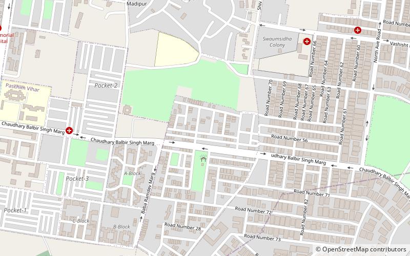
Map
Facts and practical information
Punjabi Bagh is a locality in Delhi, India. It also is one of the three sub-zones of West Delhi. ()
Coordinates: 28°40'3"N, 77°7'17"E
Address
West Delhi (Madipur)Delhi
ContactAdd
Social media
Add
Getting there by public transportation
Public transportation stops near this location
- Metro
- Bus
- Train
 Metro
Metro
- Calculate routeMadipur 16 min walk
- Calculate routeESI Hospital 20 min walk
- Calculate routeShivaji Park 20 min walk
- Calculate routePunjabi Bagh Club 17 min walk
- Calculate routeESI Hospital 20 min walk
- Calculate routeRajdhani College 24 min walk
- Calculate routeShakurbasti 27 min walk
Maps Metro
Metro
MetroDay trips


Frequently Asked Questions (FAQ)
How to get to Punjabi Bagh by public transport?
The nearest stations to Punjabi Bagh:
Metro
Bus
Train
Metro
- Madipur • Lines: Green Line (16 min walk)
- ESI Hospital • Lines: Pink Line (20 min walk)
Bus
- Punjabi Bagh Club • Lines: (-) Tms, 448, 448A, 479A (17 min walk)
- ESI Hospital • Lines: (-) Tms, (+) Tms, 448, 448A, 479A (20 min walk)
Train
- Shakurbasti (27 min walk)