Jervvasstind, Jotunheimen

Gallery (1)
Map
Map
Facts and practical information
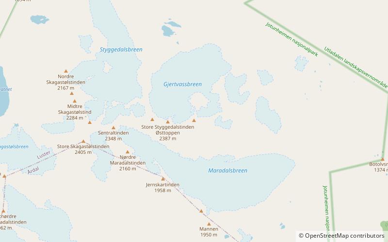
Jervvasstind is Norway's ninth-highest mountain. The 2,351-metre-tall mountain lies in the Hurrungane mountains in the eastern part of the municipality of Luster in Vestland county, Norway. It lies on the eastern end of a mountain ridge including the mountains Store Skagastølstind-Vetle Skagastølstind-Sentraltind-Store Styggedalstind-Jervvasstind. The village of Skjolden is located 16 kilometres to the west. ()
Local name: Gjertvasstind First ascent: 1876Elevation: 7713 ftProminence: 394 ftCoordinates: 61°27'53"N, 7°54'40"E
Address
Jotunheimen
ContactAdd
Social media
Add
Day trips