Kirchlispitzen
#368 among destinations in Switzerland
Facts and practical information
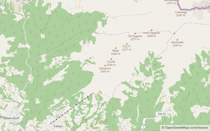
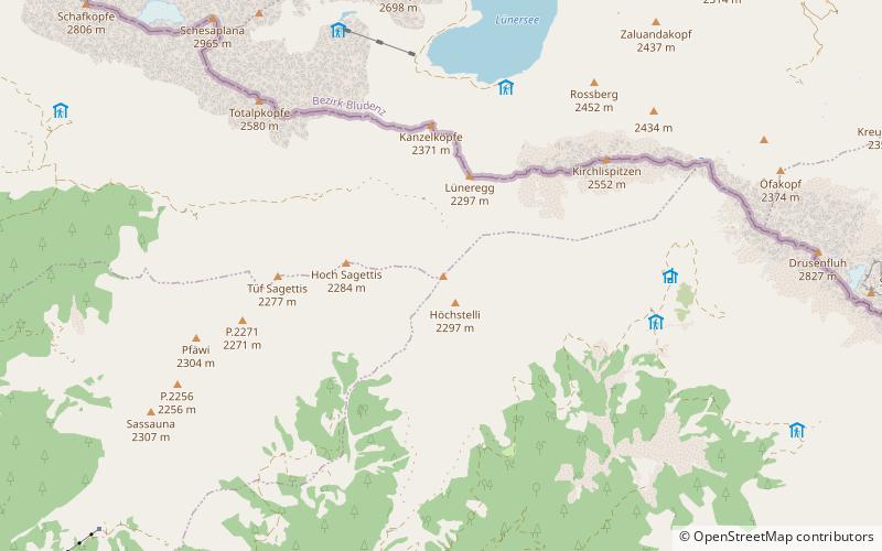
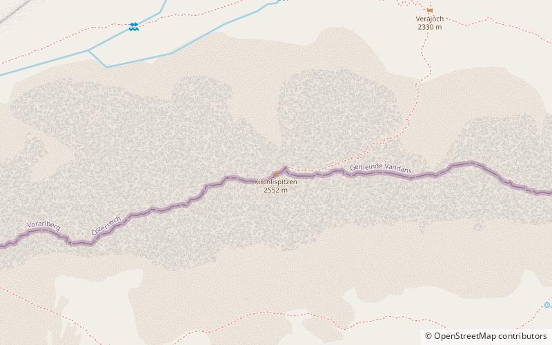
The Kirchlispitzen is a mountain in the Rätikon range of the Alps, located on the border between Austria and Switzerland. It overlooks the Lünersee on its northern side. ()
GraubündenSwitzerland
Kirchlispitzen plan & book
Unleash the traveler in you — discover the cheapest flight deals, find the perfect hotel or hostel nearby, and search for the best car rental prices. Travel at your own pace to discover new places and enjoy your journey.
Kirchlispitzen – popular in the area (distance from the attraction)
Nearby attractions include: Schesaplana, Sulzfluh, Salginatobel Bridge, Rätikon.
- 3.1 miWNature, Natural attraction, Mountain
Schesaplana
79 min walk • Schesaplana, the Queen of the Rätikon mountain range, stands as a majestic peak dominating the natural border between Switzerland and Austria. This limestone giant, reaching an altitude of 2,964 meters, is not only the highest mountain in the Rätikon range but also a...
- 3.8 miSENature, Natural attraction, Mountain
Sulzfluh
97 min walk • The Sulzfluh is a mountain in the Rätikon range of the Alps, located on the border between Austria and Switzerland. The closest locality is St. Antönien, on the southern side. It is well known by climbers and has a Via ferrata on the southern, Swiss face, in Graubünden.
- 4.6 miSWBridge
Salginatobel Bridge
118 min walk • Salginatobel Bridge is a reinforced concrete arch bridge designed by Swiss civil engineer Robert Maillart. It was constructed across an alpine ravine in the grisonian Prättigau, belonging to the municipality of Schiers, in Switzerland between 1929 and 1930.
- 3.1 miWNatural feature, Nature, Natural attraction
Rätikon
79 min walk • The Rätikon is a mountain range of the Central Eastern Alps, located at the border between Vorarlberg, Liechtenstein and Graubünden. It is the geological border between the Eastern and Western Alps and stretches from the Montafon as far as the Rhine.
- 3.8 miSWNature, Natural attraction, Mountain
Sassauna
98 min walk • The Sassauna is a mountain in the Rätikon range of the Alps, overlooking Schiers in the Swiss canton of Graubünden.
- 1.5 miSWNature, Natural attraction, Mountain
Girenspitz
38 min walk • The Girenspitz is a mountain in the Rätikon range of the Alps, located north of Schiers in the Swiss canton of Graubünden. It is the culminating poing of the group lying between the valleys of the Taschinasbach and the Schraubach.
- 5.2 miENature, Natural attraction, Mountain
Wiss Platte
133 min walk • The Wiss Platte is a mountain in the Rätikon range of the Alps, located on the border between Austria and Switzerland. It lies between Schruns and St. Antönien.
- 5.2 miSELocality
St. Antönien
134 min walk • St. Antönien is a Swiss village in the Prättigau and a municipality in the political district of Prättigau/Davos in the canton of Graubünden. The municipalities of St. Antönien and St. Antönien Ascharina merged on 1 January 2007 into St. Antönien.
- 3.5 miSEHiking, Alpine hut
Carschinahütte
90 min walk • The Carschinahütte is a refuge of the Rätia Section of the Swiss Alpine Club, in the Rätikon mountain group, in the Swiss canton of Graubünden. It is located north of St. Antönien at an altitude of 2236 m above sea level below the Sulzfluh, in a...