Pizzo Lucendro
#583 among destinations in Switzerland
Facts and practical information
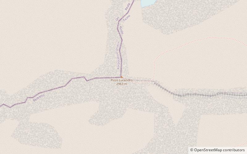
Pizzo Lucendro is a 2,963-metre-high mountain in the Lepontine Alps, located on the border between the cantons of Uri and Ticino. It overlooks St. Gotthard Pass and Lake Lucendro on its east side. ()
TicinoSwitzerland
Pizzo Lucendro plan & book
Unleash the traveler in you — discover the cheapest flight deals, find the perfect hotel or hostel nearby, and search for the best car rental prices. Travel at your own pace to discover new places and enjoy your journey.
Pizzo Lucendro – popular in the area (distance from the attraction)
Nearby attractions include: Swiss Alps, Cristallina Hut, Lago della Sella, Gotthard Pass.
- 2.4 miNEWinter sport, Ski area
Swiss Alps
62 min walk • Nestled in the heart of Europe, the Swiss Alps stand as an iconic testament to the pristine beauty and thrilling adventure that Switzerland has to offer. Known for their majestic peaks, the Alps provide a premier ski area that attracts winter sports enthusiasts from...
- 4.6 miSAlpine hut, Hiking
Cristallina Hut
119 min walk • Nestled in the heart of the Swiss Alps, the Cristallina Hut stands as a beacon for hikers and mountaineers traversing the rugged terrain of Switzerland. This alpine hut, situated at an elevation of approximately 2,575 meters, offers a serene escape amidst the majestic...
- 4.1 miNENature, Natural attraction, Lake
Lago della Sella
106 min walk • Lago della Sella is a reservoir near St. Gotthard Pass in the canton of Ticino, Switzerland. The gravity dam with a height of 36 m was completed in 1947. The dam was planned and built under control of the Swiss engineer Fritz Gigax.
- 2.6 miNENatural attraction, Mountain, Park
Gotthard Pass, Airolo
66 min walk • The Gotthard Pass or St. Gotthard Pass at 2,106 m is a mountain pass in the Alps traversing the Saint-Gotthard Massif and connecting northern with southern Switzerland.
- 2.9 miSWNature, Natural attraction, Mountain
Pizzo Rotondo
75 min walk • Pizzo Rotondo is a mountain in the Lepontine Alps. At 3,190 metres above sea level, it is the highest mountain lying on the border between the cantons of Ticino and Valais, as well as the highest summit of the Lepontine Alps lying between Nufenen Pass and Lukmanier Pass.
- 1.9 miNENature, Natural attraction, Lake
Lago di Lucendro
49 min walk • Lago di Lucendo is a reservoir at the St. Gotthard Pass in the municipality of Airolo of the canton of Ticino, Switzerland. The dam Lucendro with a height of 73 m was completed in 1947.
- 3.8 miSWNature, Natural attraction, Mountain
Chüebodenhorn
98 min walk • The Chüebodenhorn is a 3,070 metres high mountain in the Lepontine Alps, located on the border between the cantons of Valais and Ticino.
- 4.4 miWNature, Natural attraction, Mountain
Muttenhorn
113 min walk • The Muttenhorn is a mountain in the Lepontine Alps, located on the border between the cantons of Valais and Uri. At 3,099 metres above sea level, it overlooks the south side of Furka Pass.
- 4.8 miSENature, Natural attraction, Lake
Lago del Narèt
123 min walk • Lago del Narèt is a lake in Val Sambuco, Ticino, Switzerland. Its surface area is 86 ha. It is located in the municipality of Lavizzara. The closest village is Fusio.
- 5.2 miSNature, Natural attraction, Mountain
Cristallina
132 min walk • The Cristallina is a mountain of the Lepontine Alps, located in the Swiss canton of Ticino. It is situated between the valleys of Leventina, Val Bavona and Valle di Peccia the latter two belonging to the Valle Maggia. On the west side of the mountain is located the Passo Cristallina with the Cristallina Hut.
- 2.6 miWNature, Natural attraction, Mountain
Leckihorn
68 min walk • The Leckihorn is a mountain in the Lepontine Alps, located on the border between the cantons of Valais and Uri. Its summit is also named Gross Leckihorn to distinguish it from a lower summit named Chli Leckihorn.