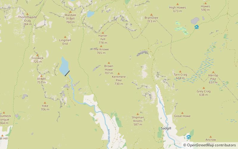
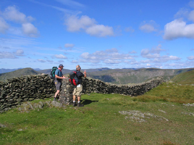
Kentmere Pike, Ambleside
#15 among attractions in Ambleside


Facts and practical information
Kentmere Pike is a fell in the English Lake District, rising between the valleys of Kentmere and Longsleddale. It is the highpoint on the ridge between Harter Fell and Shipman Knotts. ()
Ambleside United Kingdom
Ambleside plan & book
Unleash the traveler in you — discover the cheapest flight deals, find the perfect hotel or hostel nearby, and search for the best car rental prices. Travel at your own pace to discover new places and enjoy your journey.
Kentmere Pike – popular in the area (distance from the attraction)
Nearby attractions include: Kentmere Reservoir, St Cuthbert's Church, Blea Water, High Street.
1.3 miWNature, Natural attraction, LakeKentmere Reservoir
33 min walk • Kentmere Reservoir is a water storage facility situated in the Kentmere valley in the county of Cumbria, England. It is located 10.5 kilometres north-northeast of the town of Windermere.
2.3 miSChurchSt Cuthbert's Church
60 min walk • St Cuthbert's Church, Kentmere is a Grade II listed parish church in the Church of England in Kentmere, Cumbria. Its benefice is united with that of St Martin's Church, Bowness-on-Windermere; St Anne's Church, Ings; St James' Church, Staveley; Jesus Church, Troutbeck and St Mary's Church, Windermere.
2.1 miNWNature, Natural attraction, LakeBlea Water
55 min walk • Blea Water is a tarn or corrie lake which occupies a glacially excavated hollow immediately to the east of High Street in the Lake District, England. At just over 200 feet deep, it is the deepest tarn in the Lake District.
2.6 miNWNature, Natural attraction, HillHigh Street
66 min walk • High Street is a fell in the English Lake District. At 828 metres, its summit is the highest point in the far eastern part of the national park. The fell is named after the possible Roman road which ran over the summit.
1.6 miNEHillBranstree
41 min walk • Branstree is a fell in the Far Eastern part of the English Lake District. It overlooks the valley of Mardale and Haweswater Reservoir.
1 miNWNature, Natural attraction, HillHarter Fell
26 min walk • Harter Fell is a fell in the far eastern part of the English Lake District. The summit at lies the meeting point of three ridges, and Harter Fell forms the head of three valleys: Mardale, Longsleddale and the valley of the River Kent.
1.8 miWNature, Natural attraction, HillYoke
47 min walk • Yoke is a fell in the Lake District in Cumbria, England. It has a height of 706 m and is situated in the far eastern sector of the national park, 6½ kilometres ENE of the town of Ambleside.
1 miSEHillShipman Knotts, Ambleside
26 min walk • Shipman Knotts is a fell in the English Lake District in Cumbria, England. It reaches a height of 587 metres and is situated in one of the quieter areas of the national park, 2 kilometres north-east of Kentmere village.
2 miEHillGrey Crag
51 min walk • Grey Crag is a fell in the English Lake District. It stands to the east of Longsleddale in the Far Eastern Fells. There is another fell named Gray Crag in the Lake District near Hartsop.
2.6 miNEHillHowes
67 min walk • Howes is a subsidiary summit of Branstree in the English Lake District, south east of Selside Pike in Cumbria. It is the subject of a chapter of Wainwright's book The Outlying Fells of Lakeland.
2.4 miSHillGreen Quarter Fell, Windermere
61 min walk • Green Quarter Fell is an upland area in the east of the English Lake District, near Kentmere village, Cumbria. It is the subject of a chapter of Wainwright's book The Outlying Fells of Lakeland.