All Saints Church, Burton upon Trent

Gallery (1)
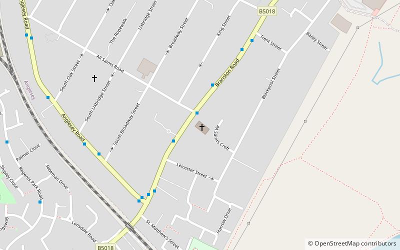
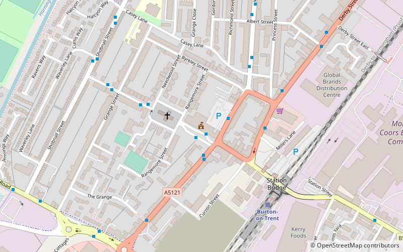
Map
Map
Facts and practical information
All Saints is a Church of England parish church situated in Burton upon Trent. It is part of the Diocese of Lichfield. ()
Coordinates: 52°47'36"N, 1°38'30"W
Address
Burton upon Trent
ContactAdd
Social media
Add
Getting there by public transportation
Public transportation stops near this location
- Bus
- Train
 Bus
Bus
- Calculate routeAll Saints Road 2 min walk
- Calculate routeLeicester Street 2 min walk
- Calculate routeAnglesey Road 4 min walk
- Calculate routeBurton-on-Trent 23 min walk
Day trips


Frequently Asked Questions (FAQ)
Which popular attractions are close to All Saints Church?
Nearby attractions include St Peter's Bridge, Burton upon Trent (15 min walk), Stapenhill, Burton upon Trent (16 min walk), Burton and South Derbyshire College, Burton upon Trent (17 min walk), Ferry Bridge, Burton upon Trent (17 min walk).
How to get to All Saints Church by public transport?
The nearest stations to All Saints Church:
Bus
Train
Bus
- All Saints Road • Lines: 11, 12, 811, 812, X12 (2 min walk)
- Leicester Street • Lines: 11, 811, 812, X12 (2 min walk)
Train
- Burton-on-Trent (23 min walk)