Black Mixen
#2711 among destinations in the United Kingdom
![Black Mixen location map](https://tzmedia.b-cdn.net/media/images/static-maps/gb/52_2718_-3_17884.jpg)
Facts and practical information
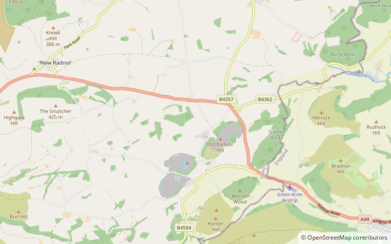
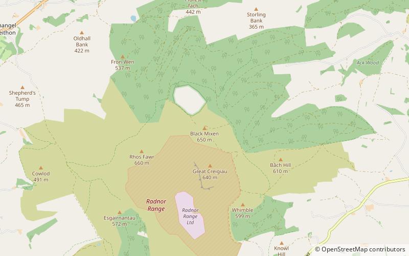
Black Mixen is a subsidiary summit of Rhos Fawr or Great Rhos in the Radnor Forest. The summit is large peat bog plateau. The summit is marked with a cairn, and is next to a radio transmitter and its building. ()
WalesUnited Kingdom
Black Mixen – popular in the area (distance from the attraction)
Nearby attractions include: Offa's Dyke, Hergest Ridge, St Stephen's Church, Bleddfa Castle.
7.4 miNEVisitor center, RuinsOffa's Dyke, Knighton
189 min walk • Offa's Dyke is a large linear earthwork that roughly follows the border between England and Wales. The structure is named after Offa, the Anglo-Saxon king of Mercia from AD 757 until 796, who is traditionally believed to have ordered its construction.
6.2 miSENature, Natural attraction, HillHergest Ridge
159 min walk • Hergest Ridge is a large elongated hill which traverses the border between England and Wales in the United Kingdom, between the town of Kington in Herefordshire and the village of Gladestry in Powys.
4.7 miSEChurchSt Stephen's Church
119 min walk • St Stephen's Church is a Church of England parish church in Old Radnor, Powys, Wales. It was constructed in the 15th century in perpendicular gothic style on the site of a 6th-century church.
2.5 miNForts and castlesBleddfa Castle
65 min walk • Bleddfa Castle was a motte and bailey structure near Llangunllo in modern-day Powys, Wales. It is believed to have been built before 1195 and abandoned by 1304.
0.9 miWNature, Natural attraction, MountainRhos Fawr
25 min walk • Rhos Fawr is a mountain summit in the Radnor Forest, a rather isolated dome of hills to the north of the village of New Radnor. The local rocks are sedimentary shales and mudstones with some Silurian limestone. With a height of 660 metres, it is the highest point in the Radnor Forest and the historic county top of Radnorshire.
5.9 miEPrehistoric siteBurfa Castle
150 min walk • Burfa Castle is an Iron Age hillfort near the tiny town of Old Radnor, Radnorshire in Powys, Wales. The site is a scheduled monument described as a prehistoric defensive hillfort, and was included in an inventory of monuments by 1913.
7.3 miNEHistory museum, MuseumKnighton Community Centre, Knighton
187 min walk • Knighton Community Centre is a venue situated in the Powys/Shropshire border town of Knighton. It is Knighton's largest venue with a current standing capacity for 650 and a seated capacity of 450.
5.5 miSENature, Natural attraction, MountainStanner Rocks
140 min walk • Stanner Rocks is a rounded hill, steep in parts, which lies close to the Wales border with England between Walton and Kington. A superb collection of wild plants can be found here.
1.2 miENature, Natural attraction, MountainBache Hill
30 min walk • Bache Hill is a subsidiary summit of Rhos Fawr or Great Rhos, in the Radnor Forest in Wales. It is located to the east of Black Mixen.
4.4 miSEForts and castlesCastle Nimble
113 min walk • Castle Nimble was a motte and bailey defensive fortification near Old Radnor, in Radnorshire, Wales. Castle Nimble appears to have had an oval-shaped ditched motte, with a semi-rectangular bailey, and some other enclosures, including possibly a pond.
6 miSNature, Natural attraction, MountainGwaunceste Hill
153 min walk • Gwaunceste Hill is a 542-metre-high hill in the county of Powys in east Wales. It falls within the communities of Gladestry and Glascwm around 4 km east of the village of Hundred House and about 2 km north of the hamlet of Glascwm.