Beinn Bharrain, Isle of Arran
#5 among attractions in Isle of Arran


Facts and practical information
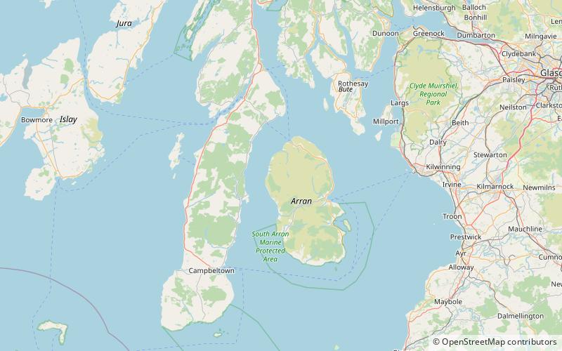
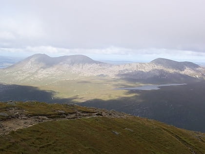
Beinn Bharrain is a mountain on the Isle of Arran, Scotland, located in the far northwest of the Island. ()
Isle of Arran United Kingdom
Beinn Bharrain – popular in the area (distance from the attraction)
Nearby attractions include: Lochranza Castle, Goat Fell, Caisteal Abhail, Beinn Tarsuinn.
 Forts and castles
Lochranza Castle, Lochranza
134 min walk • Lochranza Castle is an L-plan fortified tower house situated on a promontory in Lochranza, on the northern part of the Isle of Arran in Scotland. Most of the castle was built in the 16th century.
 Island's highest peak for hiking
Goat Fell, Isle of Arran
143 min walk • Goat Fell is the highest point on the Isle of Arran. At 874 metres, it is one of four Corbetts on the island. The mountain, along with nearby Brodick Castle, is now owned by the National Trust for Scotland. The name is believed to mean 'Goat Mountain'.
 Nature, Natural attraction, Mountain
Caisteal Abhail, Isle of Arran
107 min walk • Caisteal Abhail is a mountain on the Isle of Arran in Scotland. It is the northernmost Corbett on the island. The mountain forms the main part of a view known as The Sleeping Warrior due to its distinctive outline as seen from the mainland.
 Nature, Natural attraction, Mountain
Beinn Tarsuinn, Isle of Arran
95 min walk • Beinn Tarsuinn is a mountain on the Isle of Arran, Scotland. It is the southernmost of the four Corbetts on the island, lying between Glen Rosa to the east and Glen Iorsa to the west.
 Forts and castles
Airds Castle
149 min walk • Airds Castle is a ruined medieval castle near Carradale, Kintyre, Argyll and Bute, Scotland. The castle held a position on the summit of a rocky headland between Carradale harbour and the bay of Port Righ, looking across Kilbrannan Sound to the Isle of Arran.
 Nature, Natural attraction, Mountain
Cìr Mhòr, Isle of Arran
112 min walk • Cìr Mhòr is a Corbett known as the Matterhorn of Arran. Its name means the "big comb", referring its resemblance to a cockscomb. It is separated from the island's highest peak, Goat Fell, by a col called The Saddle.
 Nature, Natural attraction, Mountain
Torr Meadhonach, Isle of Arran
157 min walk • Torr Meadhonach is a hill 332 metres high at the northernmost part of the Isle of Arran in western Scotland, east of the village of Lochranza.
 Archaeological site
Auchagallon Stone Circle, Machrie
131 min walk • Auchagallon Stone Circle or Auchengallon cairn is the remains of a Neolithic or Bronze Age burial cairn, surrounded by a circle of fifteen stones. It is located near Machrie on the Isle of Arran in Scotland.
 Hiking, Hiking trail
Arran Coastal Way, Isle of Arran
139 min walk • The Arran Coastal Way is a 107 kilometre long-distance trail that goes around the coastline of Arran in Scotland.
 Nature, Natural attraction, Mountain
Creag Ghlas Laggan, Isle of Arran
162 min walk • Creag Ghlas Laggan is a hill on the Isle of Arran in south-western Scotland. It is the highest point of the seven-mile-long ridge of land that runs north-west to south-east between the A841 road and the Sound of Bute in the north-eastern part of the island.
 Island
Pirnmill
151 min walk • The Isle of Arran or simply Arran is an island off the west coast of Scotland. It is the largest island in the Firth of Clyde and the seventh-largest Scottish island, at 432 square kilometres.
