Fulton, Minneapolis
Map
Facts and practical information
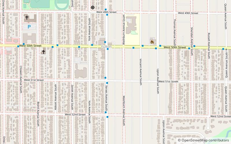
Fulton is a neighborhood in the Southwest community in Minneapolis. Its boundaries are West 47th Street to the north, Penn Avenue South to the east, West 54th Street to the south, and France Avenue South to the west. Nearby neighborhoods include Linden Hills to the north, Lynnhurst to the east, and Armatage to the south. The suburb of Edina lies to the south and west. West 50th Street is a major east–west thoroughfare bisecting the neighborhood. At its intersection with France Avenue is the upscale 50th & France commercial district, which lies along the border between Minneapolis and Edina. ()
Area: 0.88 mi²Coordinates: 44°54'40"N, 93°19'6"W
Getting there by public transportation
Public transportation stops near this location
- Bus
 Bus
Bus
- Calculate routeXerxes Av S 3 min walk
- Calculate route51 St W 12 min walk
- Calculate route50 St W 12 min walk
Day trips


Frequently Asked Questions (FAQ)
How to get to Fulton by public transport?
The nearest stations to Fulton:
Bus
Bus
- Xerxes Av S • Lines: 46A, 46D (3 min walk)
- 51 St W • Lines: 4, 4B, 4G, 4P (12 min walk)