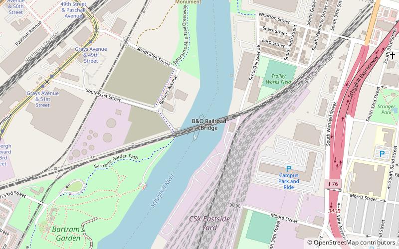
B&O Railroad Bridge, Philadelphia
Map
Facts and practical information
The B&O Railroad Bridge is a 1910 swing bridge across the Schuylkill River from Bartram's Garden on the west bank to the east bank Grays Ferry neighborhood of Philadelphia, Pennsylvania. It carries CSX Philadelphia Subdivision rail lines over the river, and sits upstream from the Passyunk Avenue Bridge and downstream from the Grays Ferry Bridge. ()
Coordinates: 39°56'8"N, 75°12'21"W
Address
Southwest PhiladelphiaPhiladelphia
ContactAdd
Social media
Add
Getting there by public transportation
Public transportation stops near this location
- Tram
- Train
 Tram
Tram
- Calculate routeGrays Avenue & 49th Street 8 min walk
- Calculate route49th Street & Paschall Avenue 11 min walk
- Calculate routeLindbergh Boulevard & Grays Avenue 12 min walk
- Calculate route49th Street 21 min walk
- Calculate routePenn Medicine 31 min walk
Maps SEPTA Regional Rail
SEPTA Regional RailDay trips


Frequently Asked Questions (FAQ)
Which popular attractions are close to B&O Railroad Bridge?
Nearby attractions include Newkirk Viaduct Monument, Philadelphia (10 min walk), Gray's Ferry Bridge, Philadelphia (10 min walk), Bartram's Garden, Philadelphia (13 min walk), South Street Bridge, Philadelphia (16 min walk).
How to get to B&O Railroad Bridge by public transport?
The nearest stations to B&O Railroad Bridge:
Tram
Train
Tram
- Grays Avenue & 49th Street • Lines: 36 (8 min walk)
- 49th Street & Paschall Avenue • Lines: 36 (11 min walk)
Train
- 49th Street (21 min walk)
- Penn Medicine (31 min walk)