Kingman Park, Washington D.C.
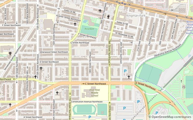
Map
Facts and practical information
Kingman Park is a residential neighborhood in the Northeast quadrant of Washington, D.C., the capital city of the United States. Kingman Park's boundaries are 15th Street NE to the west; C Street SE to the south; Benning Road to the north; and Anacostia Park to the east. The neighborhood is composed primarily of two-story brick rowhouses. Kingman Park is named after Brigadier General Dan Christie Kingman, the former head of the United States Army Corps of Engineers. ()
Coordinates: 38°53'42"N, 76°58'42"W
Address
Northeast Washington (Kingman Park)Washington D.C.
ContactAdd
Social media
Add
Getting there by public transportation
Public transportation stops near this location
- Metro
- Tram
 Metro
Metro
- Calculate routeBenning Road & 19th Street Northeast 8 min walk
- Calculate routeH Street & 13th Street Northeast 17 min walk
- Calculate routeStadium–Armory 15 min walk
- Calculate routePotomac Avenue 26 min walk
Day trips


Frequently Asked Questions (FAQ)
Which popular attractions are close to Kingman Park?
Nearby attractions include Rosedale Recreation Center, Washington D.C. (5 min walk), Starburst Intersection, Washington D.C. (12 min walk), East Capitol Street Car Barn, Washington D.C. (12 min walk), Holy Comforter-St. Cyprian Catholic Church, Washington D.C. (15 min walk).
How to get to Kingman Park by public transport?
The nearest stations to Kingman Park:
Tram
Metro
Tram
- Benning Road & 19th Street Northeast • Lines: H Street/Benning Road Streetcar (8 min walk)
- H Street & 13th Street Northeast • Lines: H Street/Benning Road Streetcar (17 min walk)
Metro
- Stadium–Armory • Lines: Bl, Or, Sv (15 min walk)
- Potomac Avenue • Lines: Bl, Or, Sv (26 min walk)