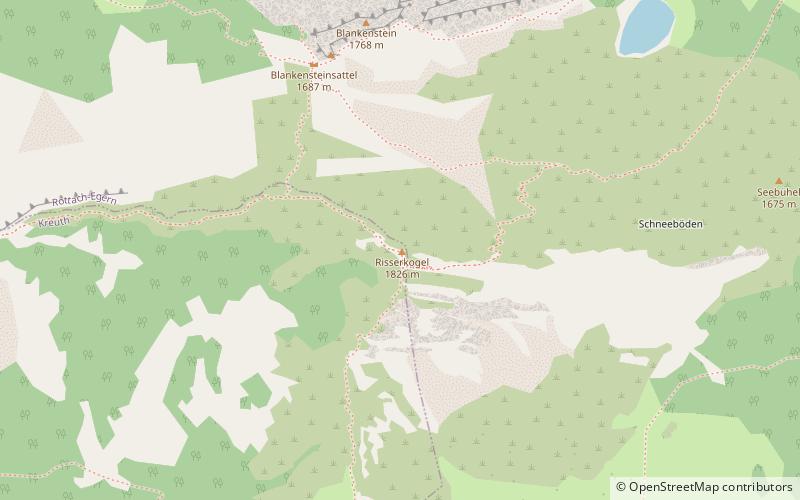
Risserkogel
#982 among destinations in Germany

Facts and practical information
Risserkogel is a mountain of Bavaria, Germany. ()
BavariaGermany
Risserkogel plan & book
Unleash the traveler in you — discover the cheapest flight deals, find the perfect hotel or hostel nearby, and search for the best car rental prices. Travel at your own pace to discover new places and enjoy your journey.
Risserkogel – popular in the area (distance from the attraction)
Nearby attractions include: Schloss Ringberg, Tegernsee Abbey, Brecherspitz, Wallberg.
 Forts and castles
Schloss Ringberg
98 min walk • Perched atop the lush hills of Bavaria, Schloss Ringberg offers a glimpse into the grandeur of early 20th-century German aristocracy and the imaginative spirit of its former owner. This striking castle, with its blend of traditional and fantastical architectural...
 Baroque architecture, Monastery
Tegernsee Abbey, Tegernsee
136 min walk • Tegernsee Abbey is a former Benedictine monastery in the town and district of Tegernsee in Bavaria. Both the abbey and the town that grew up around it, are named after the Tegernsee, the lake on the shores of which they are located.
 Nature, Natural attraction, Trail
Brecherspitz, Schliersee
107 min walk • The Brecherspitz is a mountain in Bavaria, Germany. It is about 18 minutes from nearby towns of Fischbachau and Schliersee. From the top, you can see views of small lake Spitzingsee, Miesbach District, and Austrian Border.
 Natural attraction, Nature, Mountain
Wallberg
52 min walk • Wallberg is a mountain in the Mangfallgebirge, part of the Bavarian Alps in the south of Bavaria, Germany.
 Natural attraction, Nature, Mountain
Hirschberg
135 min walk • The Hirschberg is a 1,670-metre-high mountain in the Bavarian Fore-alps south of Lake Tegernsee. The summit may be reached via a gentle mountain path either from Scharling, Kreuth or Bad Wiessee, all three routes being classified as not difficult.
 Nature, Natural attraction, Mountain
Bodenschneid, Spitzingsee
74 min walk • The Bodenschneid is a 1,668 m high mountain in the Schliersee Mountains in the Mangfall range in the German Free State of Bavaria.
 Nature, Natural attraction, Mountain
Roßkopf, Spitzingsee
77 min walk • The Roßkopf is a 1,580-metre-high peak in the Mangfall Mountains in Upper Bavaria. It lies in the south of the district of Miesbach right on the boundary between the parishes of Schliersee in the east and Rottach-Egern in the west, which forms the watershed between the lakes of Schliersee and Tegernsee.
 Mountain with hiking trails and lake views
Baumgartenschneid
116 min walk • The Baumgartenschneid is a 1,448 metre high mountain in the Bavarian Prealps above the Tegernsee to the east.
 Natural attraction, Nature, Mountain
Schinder Mountain
93 min walk • Schinder is a mountain on the border of Bavaria, Germany and Tyrol, Austria. There are two summits, one called Austrian Schinder or Trausnitzberg, and the other slightly lower one called Bavarian Schinder.
 Mountain with hiking routes and views
Aiplspitz, Spitzingsee
157 min walk • The Aiplspitz is a 1,759 meter high mountain in the Rotwand group east of the Spitzingsee in the Bavarian Prealps, Germany.
 47°42'27"N • 11°52'41"E
Markus Wasmeier outdoor museum, Schliersee
153 min walk • History museum, Specialty museum, Museum


