Kummelberg, Bad Lauterberg
#2 among attractions in Bad Lauterberg


Facts and practical information
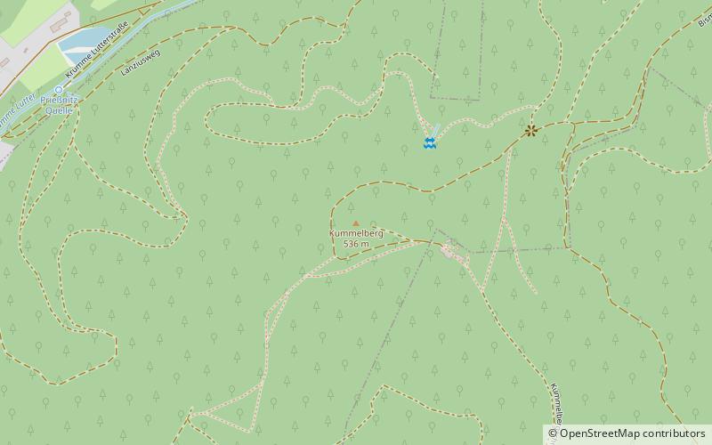
The Kummelberg, also called Kummel, in the low mountain range Harz is a 536 m above sea level mountain on the border of the urban area of Bad Lauterberg to the municipality-free area Harz of the district of Göttingen.
Bad Lauterberg Germany
Kummelberg – popular in the area (distance from the attraction)
Nearby attractions include: Unicorn Cave, Ravensberg, Burg Scharzfels, Oder Dam.
2.8 miW
Nature, Natural attraction, CaveUnicorn Cave
72 min walk • Unicorn Cave, situated in the Harz Mountains of Germany, is a natural wonder shrouded in myth and geological significance. This subterranean marvel, known in German as "Einhornhöhle," which translates to "Unicorn Cave," has captured the imagination of visitors for...
2.8 miSE
Nature, Natural attraction, MountainRavensberg, Bad Sachsa
72 min walk • The Ravensberg is a 659 m high mountain in the South Harz mountains in the German state of Lower Saxony. It is relatively isolated and visible for a long way. It lies in the district of Göttingen, north of Bad Sachsa. The mountain top is crowned with a prominent 64 m high tower, which was built in 1970.
2.7 miW
Forts and castlesBurg Scharzfels
70 min walk • Perched atop a rocky promontory in the Harz Mountains, Burg Scharzfels stands as a sentinel over the scenic landscapes of Lower Saxony, Germany. This medieval castle, whose origins date back to the 10th century, is a testament to the region's rich history...
2.4 miNE
Historic dam with an eatery and reservoirOder Dam
62 min walk • The Oder Dam is a dam in the Harz mountains of Germany. It lies above Bad Lauterberg in the district of Göttingen in Lower Saxony and impounds the river Oder. The dam went into service in 1934 after taking 3 years to build. The owner and operator of the Oder Dam is the Harzwasserwerke.
3.8 miE
Nature, Natural attraction, MountainStöberhai
97 min walk • The Stöberhai is a mountain the Harz highlands in Central Germany, immediately south of the Oder Dam and northwest of Wieda. At a height of 720 m above sea level it is the highest mountain in the South Harz.
2.5 miNW
Forested peak with trails and a viewpointGroßer Knollen
64 min walk • The Großer Knollen is a 687.4-metre-high mountain in the southwestern part of the Harz in Lower Saxony, Germany.
3.2 miN
Nature, Natural attraction, MountainKoboltstaler Köpfe
83 min walk • The Koboltstaler Köpfe are a group of three mountains, that rise southwest of Sankt Andreasberg and east of Sieber in the district of Göttingen in Lower Saxony.
3.6 miNW
Nature, Natural attraction, HillAdlersberg
92 min walk • The Adlersberg is a hill in the Harz mountains of central Germany that lies south of Sieber in the district of Göttingen in Lower Saxony. It is 593.2 m high and is situated west of the Aschentalshalbe. It also separates the valley of Breitental with its river, the Tiefenbeek, from the Langental.
3.5 miW
Nature, Natural attraction, HillEichelnkopf
89 min walk • The Eichelnkopf is a 545.7 m high hill in the southwestern part of the Harz Mountains in the central German state of Lower Saxony.
2.5 miN
Nature, Natural attraction, HillSchadenbeeksköpfe
65 min walk • The Schadenbeeksköpfe are two summits on a southeastern outlier of the Aschentalshalbe in the Harz Mountains of Germany, about 3.6 kilometres southeast of Sieber in the district of Göttingen in Lower Saxony.
4 miW
Nature, Natural attraction, CaveSteinkirche
102 min walk • The stone church Scharzfeld in the Harz Mountains is a cave near the Herzberg district of Scharzfeld in the district of Göttingen in southern Lower Saxony.
