Schlierseer Bauerntheater, Schliersee
#2 among attractions in Schliersee


Facts and practical information
Schlierseer Bauerntheater is a theatre in Schliersee, Bavaria, Germany. ()
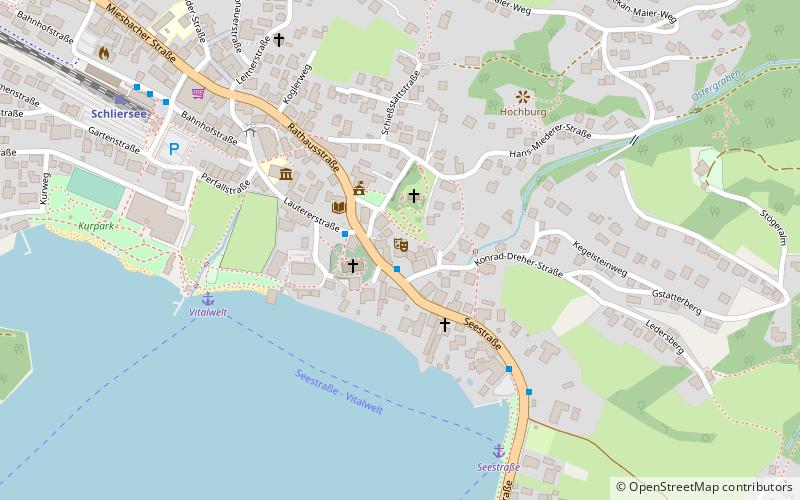
Xaver-Terofal-Platz 1Schliersee Germany
Schlierseer Bauerntheater – popular in the area (distance from the attraction)
Nearby attractions include: Schliersee Lake, Tegernsee Abbey, Brecherspitz, Wallberg.
0.7 miSNature, Natural attraction, LakeSchliersee Lake, Schliersee
19 min walk • Schliersee is a natural lake in Upper Bavaria in the Bavarian Alps. It is located next to the small town of Schliersee in the Miesbach district.
5.4 miWBaroque architecture, MonasteryTegernsee Abbey, Tegernsee
137 min walk • Tegernsee Abbey is a former Benedictine monastery in the town and district of Tegernsee in Bavaria. Both the abbey and the town that grew up around it, are named after the Tegernsee, the lake on the shores of which they are located.
3.9 miSNature, Natural attraction, TrailBrecherspitz, Schliersee
101 min walk • The Brecherspitz is a mountain in Bavaria, Germany. It is about 18 minutes from nearby towns of Fischbachau and Schliersee. From the top, you can see views of small lake Spitzingsee, Miesbach District, and Austrian Border.
5.7 miSWNatural attraction, Nature, MountainWallberg
145 min walk • Wallberg is a mountain in the Mangfallgebirge, part of the Bavarian Alps in the south of Bavaria, Germany.
4.4 miSNature, Natural attraction, MountainBodenschneid, Spitzingsee
114 min walk • The Bodenschneid is a 1,668 m high mountain in the Schliersee Mountains in the Mangfall range in the German Free State of Bavaria.
5.4 miSNature, Natural attraction, MountainRoßkopf, Spitzingsee
137 min walk • The Roßkopf is a 1,580-metre-high peak in the Mangfall Mountains in Upper Bavaria. It lies in the south of the district of Miesbach right on the boundary between the parishes of Schliersee in the east and Rottach-Egern in the west, which forms the watershed between the lakes of Schliersee and Tegernsee.
3.4 miSWMountain with hiking trails and lake viewsBaumgartenschneid
87 min walk • The Baumgartenschneid is a 1,448 metre high mountain in the Bavarian Prealps above the Tegernsee to the east.
5 miSEMountain with hiking routes and viewsAiplspitz, Spitzingsee
127 min walk • The Aiplspitz is a 1,759 meter high mountain in the Rotwand group east of the Spitzingsee in the Bavarian Prealps, Germany.
1.9 miS47°42'27"N • 11°52'41"EMarkus Wasmeier outdoor museum, Schliersee
48 min walk • History museum, Specialty museum, Museum
4.3 miSNature, Natural attraction, MountainRinnerspitz, Spitzingsee
111 min walk • The Rinnerspitz is a 1,611 m high peak in the Schliersee Mountains in the Mangfall mountain range in the German Free State of Bavaria. It is also known by locals as the Peißenberg. It was here on 6 November 1877 that the poacher, Georg Jennerwein, was shot in the back.
1.5 miW