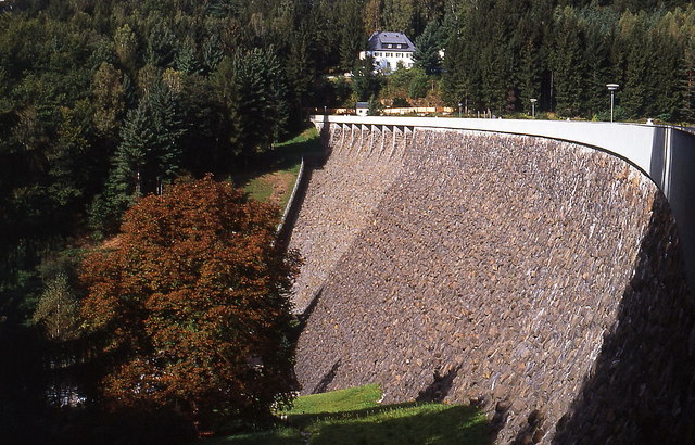
Saidenbach Dam

Gallery (2)
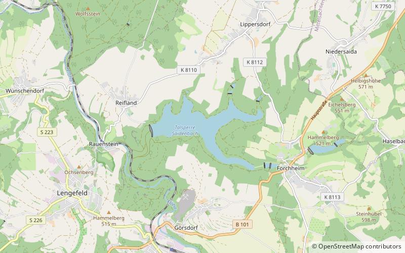
Map
Map
Gallery
Facts and practical information
The Saidenbach Dam is a dam in the German state of Saxony. Its reservoir supplies drinking water to Chemnitz and, in conjunction with the Central Ore Mountain Dam System and its other dams - Neunzehnhain I und II and Einsiedel - contributes to the supply of the region covered by the South Saxony Long Distance Water Association. ()
Local name: Talsperre Saidenbach Length: 1096 ftHeight: 192 ftReservoir area: 0.55 mi²Elevation: 1457 ft a.s.l.Coordinates: 50°44'1"N, 13°14'13"E
Location
Saxony
ContactAdd
Social media
Add
Day trips