Rauenstein Castle
#678 among destinations in Germany
![Rauenstein Castle location map](https://tzmedia.b-cdn.net/media/images/static-maps/de/50_7288_13_201.jpg)
![Rauenstein Castle](https://tzmedia.b-cdn.net/media/images/de/place/gallery/medium/222b5f48ef885e88ccccc791cadbf898.jpg)
Facts and practical information
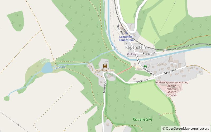
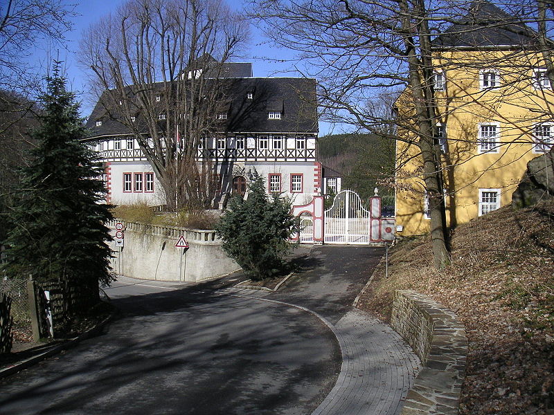
Rauenstein Castle is a castle in the village of Rauenstein in the town of Pockau-Lengefeld in the Ore Mountains of Central Europe. The castle guarded the crossing over the River Flöha along the road from Freiberg to Annaberg. ()
Rauenstein Castle plan & book
Unleash the traveler in you — discover the cheapest flight deals, find the perfect hotel or hostel nearby, and search for the best car rental prices. Travel at your own pace to discover new places and enjoy your journey.
Rauenstein Castle – popular in the area (distance from the attraction)
Nearby attractions include: Lengefeld Lime Works, St Mary's Church, Lauterstein Castle, Saidenbach Dam.
2.2 miSWMuseumLengefeld Lime Works
58 min walk • Nestled in the picturesque landscapes of Saxony, Germany, the Lengefeld Lime Works stands as a testament to the industrial heritage and the long-standing tradition of lime production in the region. This historic site, now functioning as a museum, offers visitors a...
5.6 miSChurch, Gothic architectureSt Mary's Church, Ore Mountains/Vogtland Nature Park
144 min walk • St. Mary's Church in Marienberg in the German state of Saxony is an Evangelical-Lutheran church in the southeast of the county of Erzgebirgskreis. It is the most recent of the three Ore Mountain Late Gothic hall churches.
4.2 miSForts and castlesLauterstein Castle, Ore Mountains/Vogtland Nature Park
107 min walk • Lauterstein Castle, in German Burg Lauterstein, also called Burgruine Niederlauterstein, is a medieval castle in Niederlauterstein, town of Marienberg, Erzgebirgskreis, Saxony. It has been a ruin since the Thirty Years' War.
1.6 miENature, Natural attraction, LakeSaidenbach Dam
41 min walk • The Saidenbach Dam is a dam in the German state of Saxony. Its reservoir supplies drinking water to Chemnitz and, in conjunction with the Central Ore Mountain Dam System and its other dams - Neunzehnhain I und II and Einsiedel - contributes to the supply of the region covered by the South Saxony Long Distance Water Association.
4.5 miWNature, Natural attraction, MountainPilzhübel
114 min walk • Pilzhübel is a mountain in Saxony's Ore Mountains, southeastern Germany. Although its appearance is that of a broad hill without steep slopes, its geographical position allows for wide panoramic views of the surrounding valleys and peaks of the Ore Mountains including...
3 miSWNature, Natural attraction, MountainLauterbacher Knochen
78 min walk • The Lauterbacher Knochen is a 683-metre-high peak about one kilometre north of the village of Lauterbach in the municipality of Marienberg in the Ore Mountains.
2.6 miSWNature, Natural attraction, MountainAdlerstein
67 min walk • The Adlerstein is a 676-metre-high summit in the Saxon Ore Mountains near Lengefeld. At the top there is a historic triangulation station which was part of the Royal Saxon triangulation network.
7.1 miNE 5.1 miS50°39'33"N • 13°9'38"EFreizeitbad AQUA MARIEN, Marienberg
131 min walk • Watersports, Spa, Sport complex
5.1 miSTownZöblitz, Ore Mountains/Vogtland Nature Park
131 min walk • Zöblitz is a town in the district Erzgebirgskreis, in Saxony, Germany. It is situated in the Ore Mountains, 5 kilometres east of Marienberg, and 30 kilometres southeast of Chemnitz. Since 31 December 2012, it is part of the municipality of Marienberg.
6.1 miSWNature, Natural attraction, MountainDreibrüderhöhe
156 min walk • Dreibrüderhöhe or short Brüderhöhe is a mountain of Saxony, southeastern Germany. It is located near Marienberg in Saxony and can reached by a road branching off Bundesstraße 171, or on hiking routes from Marienberg, Wolkenstein, Lauta, Großrückerswalde or Gehringswalde, among...