Hopfenberg
#1844 among destinations in Germany

Facts and practical information
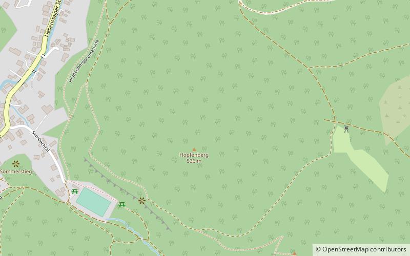
The Hopfenberg is a wooded hill near Winterstein in the borough of Waltershausen, in the county of Gotha in the German state of Thuringia. ()
ThuringiaGermany
Hopfenberg plan & book
Unleash the traveler in you — discover the cheapest flight deals, find the perfect hotel or hostel nearby, and search for the best car rental prices. Travel at your own pace to discover new places and enjoy your journey.
Hopfenberg – popular in the area (distance from the attraction)
Nearby attractions include: mini-a-thür, Altenstein Palace, Schloss Reinhardsbrunn, Großer Inselsberg.
 Amusement, Amusement park
mini-a-thür
125 min walk • The mini-a-thür amusement park is located in Ruhla, Thuringia. The permanent exhibition features 1:25 scale models of Thuringian landmarks during the summer months in an outdoor area. In winter, the models are stored in a museum hall.
 Forts and castles
Altenstein Palace, Bad Liebenstein
142 min walk • Schloss Altenstein is a schloss, or palace, upon a rocky hill on the south-western slope of the Thuringian Forest, not far from Eisenach, Thuringia, Germany.
 Forts and castles, Palace, Historical place
Schloss Reinhardsbrunn, Friedrichroda
111 min walk • Reinhardsbrunn in Friedrichroda near Gotha, in the German state of Thuringia, is the site of a formerly prominent Benedictine abbey, the house monastery of the Ludovingian Landgraves of Thuringia abbey extant between 1085 and 1525.
 Nature, Natural attraction, Mountain
Großer Inselsberg
44 min walk • Großer Inselsberg is a mountain in the Thuringian Forest with a height of 916.5 m above sea level, located on Rennsteig in the districts of Gotha and Schmalkalden-Meiningen.
 Nature, Natural attraction, Rock
Kilianstein
8 min walk • The Kilianstein is a free-standing rock tower on the Hopfenberg hill in the eastern part of the Sembach valley in central Germany. It stands about 800 m east of the village of Winterstein on the northern slopes of the Thuringian Forest in Germany. The pinnacle is about 15 metres high and some 500 m above sea level.
 Forts and castles
Schloss Tenneberg, Waltershausen
107 min walk • Tenneberg Castle is the remnant of a medieval spur castle complex of the Thuringian landgraves, which served as a hunting lodge and secondary residence of the dukes of Gotha through several reconstructions and is currently used as a museum.
 Park, Outdoor activities, Zoo
Tierpark Bad Liebenstein, Bad Liebenstein
155 min walk • The Bad Liebenstein Zoo is a small zoo at the foot of the castle hill in the small town of Bad Liebenstein in southern Thuringia.
 Forts and castles
Burg Liebenstein, Bad Liebenstein
152 min walk • The ruins of Liebenstein Castle is a former hilltop castle at 460 m above sea level on the southwestern slope of the Thuringian Forest. It is located north above the town of Bad Liebenstein on the castle or Burgberg.

 Forts and castles
Scharfenburg
96 min walk • The Scharfenburg, at times also called Scharfenberg, is the ruin of a more than 900-year-old hilltop castle in the district of Thal of the town of Ruhla in the Wartburgkreis in Thuringia.
 Tower
TowerCarl-Alexander-Turm
125 min walk • The Ringberg with the Carl Alexander Tower is a 638.9 m above sea level mountain in the Thuringian Forest near Ruhla in Wartburgkreis, Thuringia. Apart from some castle towers and monuments, the Alexander Tower on its summit is the only preserved...


