Spießhorn
#1199 among destinations in Germany
![Spießhorn location map](https://tzmedia.b-cdn.net/media/images/static-maps/de/47_8307_8_04199.jpg)
Facts and practical information
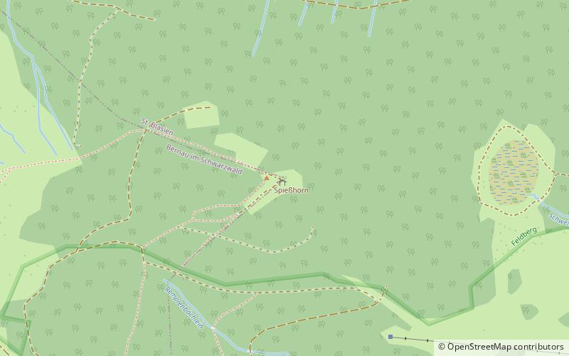
The Spießhorn is a mountain, 1,348.9 m above NHN high, in the Black Forest just east of the Herzogenhorn. The summit is on the boundary between St. Blasien and Bernau im Schwarzwald. The Spießhorn is largely forested. At the summit is an observation pavilion. To the southwest is a subpeak, the Kleines Spießhorn. ()
Baden-WürttembergGermany
Spießhorn plan & book
Unleash the traveler in you — discover the cheapest flight deals, find the perfect hotel or hostel nearby, and search for the best car rental prices. Travel at your own pace to discover new places and enjoy your journey.
Spießhorn – popular in the area (distance from the attraction)
Nearby attractions include: Feldsee, Herzogenhorn, Windgfällweiher, Schluchsee.
2.7 miNNature, Natural attraction, LakeFeldsee
70 min walk • Nestled in the heart of the Black Forest, Feldsee is a serene lake in Germany that offers a picturesque escape into nature. This glacial lake, formed during the last Ice Age, is surrounded by steep hills and dense forests, creating a tranquil atmosphere for visitors...
1.1 miWNature, Natural attraction, MountainHerzogenhorn
29 min walk • Herzogenhorn, Germany, presents an impressive peak that beckons outdoor enthusiasts and nature lovers alike. Standing at an elevation of 1,415 meters, Herzogenhorn is the third highest mountain in the Black Forest, offering breathtaking views that span across rolling...
4.1 miENature, Natural attraction, LakeWindgfällweiher, Lenzkirch
106 min walk • The Windgfällweiher is a reservoir between the Titisee and the Schluchsee in the south of Baden-Württemberg, Germany. It is located within the High Black Forest and lies in a hollow formed by ice age glaciation between the villages of Altglashütten, Falkau and Aha on the territory of the municipality of Lenzkirch.
5.2 miEPicturesque lake for swimming and sailingSchluchsee
134 min walk • Nestled in the heart of the Black Forest, Schluchsee is a serene getaway and the largest lake in the region of Baden-Württemberg, Germany. This man-made lake, with its origins as a glacial lake, was enlarged with a dam in the 1930s and has since become a beloved...
2.3 miNNature, Natural attraction, MountainSeebuck
60 min walk • Nestled in the heart of the Black Forest, Seebuck is a mountain peak that offers breathtaking views and a wealth of outdoor activities. With an elevation of 1,448 meters, it is one of the prominent peaks in the Feldberg area, the highest mountain range in the state of...
4.3 miWNature, Natural attraction, MountainHasenhorn, Todtnau
109 min walk • The Hasenhorn is a mountain, 1,155.6 m above sea level, in the Southern Black Forest in Germany. The mountain lies southeast of the little town of Todtnau.
4.2 miNENature, Natural attraction, LakeMathisleweiher
108 min walk • Nestled in the lush forests of the Black Forest in Germany, Mathisleweiher is a serene lake that offers a tranquil escape from the hustle and bustle of city life. This idyllic body of water is a hidden gem known for its crystal-clear waters and the peaceful ambiance...
4.4 miNWHiking, Hiking trailAlpine Path
112 min walk • Nestled in the picturesque landscapes of Germany, the Alpine Path beckons outdoor enthusiasts with its stunning vistas and invigorating trails. This hiking trail is a jewel in the crown of Germany's natural splendors, offering a chance to escape into the serenity of...
4.1 miNWNature, Natural attraction, MountainStübenwasen
106 min walk • Nestled in the heart of the Black Forest in Germany, Stübenwasen stands as a testament to the region's natural beauty. This mountain, rising to an elevation of 1,386 meters, is a favored destination for hikers and nature enthusiasts.
5.1 miSWNature, Natural attraction, MountainHochkopf
130 min walk • The Hochkopf is a wooded ridge north of the village of Todtmoos in the southern part of the High Black Forest. At 1,263.4 m above sea level its summit is one of the 20 highest points in the German state of Baden-Württemberg.
1.3 miE47°49'33"N • 8°4'8"ERadon Revital Bad, Sankt Blasien
33 min walk • Watersports, Water park, Amusement park