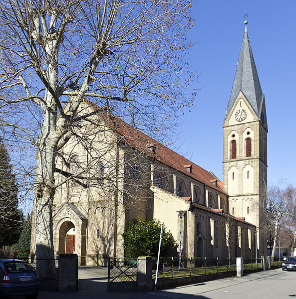
Sankt Peter, Heidelberg

Gallery (3)
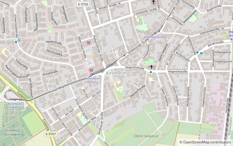
Map

Map
Gallery
Facts and practical information
St. Peter is the Roman Catholic parish church of the Heidelberg district of Kirchheim. It was built in 1908-1909 in the neo-Romanesque style and is dedicated to St. Peter the Apostle.
Address
41 Lochheimer StraßeHeidelberg
ContactAdd
Social media
Add
Getting there by public transportation
Public transportation stops near this location
- Bus
- Tram
- Train
 Bus
Bus
- Calculate routeOdenwaldstraße 3 min walk
- Calculate routeAlbert-Fritz-Straße 6 min walk
- Calculate routeKirchheim Rathaus 8 min walk
- Calculate routeIlse-Krall-Straße 12 min walk
- Calculate routeHagellachstraße 6 min walk
- Calculate routeObere Seegasse 6 min walk
- Calculate routeKönigsberger Straße 8 min walk
- Calculate routeKirchheim Rathaus 8 min walk
- Calculate routeHeidelberg-Kirchheim/Rohrbach 8 min walk
Day trips


Frequently Asked Questions (FAQ)
How to get to Sankt Peter by public transport?
The nearest stations to Sankt Peter:
Tram
Bus
Train
Tram
- Odenwaldstraße • Lines: 26 (3 min walk)
- Albert-Fritz-Straße • Lines: 26 (6 min walk)
Bus
- Hagellachstraße • Lines: 33, M3 (6 min walk)
- Obere Seegasse • Lines: 33, M3 (6 min walk)
Train
- Heidelberg-Kirchheim/Rohrbach (8 min walk)