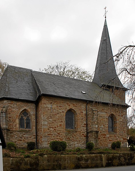
Schloßkirche Bodelschwingh, Dortmund

Gallery (2)
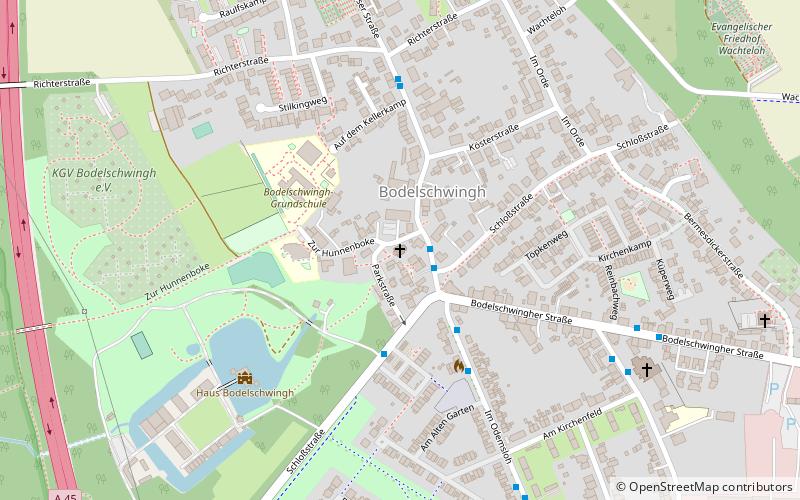
Map
Map
Gallery
Facts and practical information
The Protestant church is a listed church building located at Parkstraße 9 in Bodelschwingh, a district of Dortmund in North Rhine-Westphalia, Germany.
Architectural style: GothicCoordinates: 51°33'9"N, 7°21'56"E
Getting there by public transportation
Public transportation stops near this location
- Bus
- Train
 Bus
Bus
- Calculate routeBodelschwingh 1 min walk
- Calculate routeKräutergarten 3 min walk
- Calculate routeBodelschwingh Feuerwache 3 min walk
- Calculate routeRichterstraße 4 min walk
- Calculate routeDortmund-Westerfilde 18 min walk
- Calculate routeDortmund-Nette/Oestrich 21 min walk
Day trips


Frequently Asked Questions (FAQ)
How to get to Schloßkirche Bodelschwingh by public transport?
The nearest stations to Schloßkirche Bodelschwingh:
Bus
Train
Bus
- Bodelschwingh • Lines: 471, 477 (1 min walk)
- Kräutergarten • Lines: 477 (3 min walk)
Train
- Dortmund-Westerfilde (18 min walk)
- Dortmund-Nette/Oestrich (21 min walk)