Wirtelstraße, Düren
Map

Map

Facts and practical information
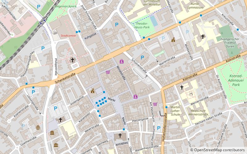
Wirtelstraße in the district town of Düren is an old inner-city street.
The street connects Kölnstraße with Schenkelstraße and Wirteltorplatz. Wirtelstraße is developed as a pedestrian zone. It is the main shopping street of the city. At the end of Wirtelstraße, on Wirteltorplatz, used to stand the Wirteltor, which was part of the city fortifications of Dueren. In Wirtelstraße stands the fountain with the figures of the original people of Düren.
Coordinates: 50°48'14"N, 6°29'3"E
Address
Düren
ContactAdd
Social media
Add
Day trips
Wirtelstraße – popular in the area (distance from the attraction)
Nearby attractions include: Leopold-Hoesch-Museum, Christ Church, Chlodwigplatz, Annakirche.
Frequently Asked Questions (FAQ)
Which popular attractions are close to Wirtelstraße?
Nearby attractions include Christ Church, Düren (5 min walk), Pletzergassenturm, Düren (5 min walk), Annakirche, Düren (5 min walk), Leopold-Hoesch-Museum, Düren (7 min walk).
How to get to Wirtelstraße by public transport?
The nearest stations to Wirtelstraße:
Bus
Train
Bus
- Kaiserplatz • Lines: 202, 203, 204, 205, 206, 207, 208, 209, 210, 211, 213, 214, 216, 221, 222, 224, 225, 236, 286, 291, 296, 297, Citybus, Sb 38, Sb 8, Sb 86, Sb 98, Stadtring A, Stadtring B (4 min walk)
Train
- Düren (11 min walk)
- Annakirmesplatz (18 min walk)


