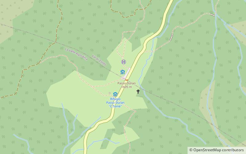
Duran Pass
#2335 among destinations in Italy


Facts and practical information
VenetoItaly
Duran Pass – popular in the area (distance from the attraction)
Nearby attractions include: Monte Civetta, Rifugio Sonino al Coldai, Giardino Alpino "Antonio Segni", Monte Talvena.
 Nature, Natural attraction, Mountain
Monte Civetta, Dolomites
110 min walk • Monte Civetta is a prominent and major mountain of the Dolomites, in the Province of Belluno in northern Italy. Its north-west face can be viewed from the Taibon Agordino valley, and is classed as one of the symbols of the Dolomites.
 Hiking, Alpine hut
Rifugio Sonino al Coldai, Zoldo Alto
135 min walk • The Sonino al Coldai refuge is a refuge located in the municipality of Val di Zoldo, in the Ziolere valley in the Dolomites, at 2,132 m above sea level near Coldai Lake.
 Botanical garden
Giardino Alpino "Antonio Segni", Dolomites
117 min walk • The Giardino Alpino "Antonio Segni" is an alpine botanical garden located at 1,714 meters altitude in Refugio Vazzoler, Gruppo del Civetta, Col Negro di Pelsa, Taibon Agordino, Province of Belluno, Veneto, Italy. It is privately owned with a municipal affiliation, and open daily when Refugio Vazzoler is open.
 Mountain
Monte Talvena, Forno di Zoldo
126 min walk • Monte Talvena is a mountain of the Dolomites in Veneto, Italy. It has an elevation of 2,542 metres.
 Town
TownAgordo
107 min walk • Agordo is a town and comune sited in the Province of Belluno, in the Veneto region in Italy. It is located about 100 kilometres north of Venice and about 20 kilometres northwest of Belluno.
 Nature, Natural attraction, Mountain
Moiazza Sud, Dolomites
52 min walk • Moiazza - a peak in the Dolomites, in the Eastern Alps. It lies in northern Italy, in the Venice of the Euganska. On the southern tip of the summit leads the Via Ferrata road: Via Ferrata Costantini, considered one of the most difficult in the Dolomites and many climbing roads.
 Locality
La Valle Agordina
85 min walk • La Valle Agordina is a comune in the Province of Belluno in the Italian region Veneto, located about 90 kilometres north of Venice and about 20 kilometres northwest of Belluno.
 Hiking, Alpine hut
Rifugio Capanna Trieste
85 min walk • The Capanna Trieste hut is a large building that stands in the Corpassa valley, with views of the Civetta and Moiazza mountain ranges, easily accessible via the Val Corpassa road that starts from Listolade and ends right at the hut.
 Alpine hut, Hiking
Rifugio Maria Vittoria Torrani, Dolomites
106 min walk • The Maria Vittoria Torrani Refuge is a Dolomite mountain refuge located in the municipality of Zoldo Alto in the Zoldana Valley, on the Pian della Tenda, on the east side of Mount Civetta, at 2,984 m above sea level.
 Hiking, Alpine hut
Rifugio Attilio Tissi
135 min walk • The Attilio Tissi refuge at Col Reàn is a dolomite alpine refuge located in the municipality of Alleghe in the Agordino area, on Col Reàn, near the great northwest face of Mount Civetta, at 2 250 m above sea level.
 Hiking, Alpine hut
Rifugio Mario Vazzoler
94 min walk • The Mario Vazzoler refuge at Col Negro di Pelsa is a refuge located in the municipality of Taibon Agordino, in the Corpassa valley. It rises on the slopes of the Mount Civetta group, at 1,714 m above sea level.
