Parco della Repubblica, Modena

Facts and practical information
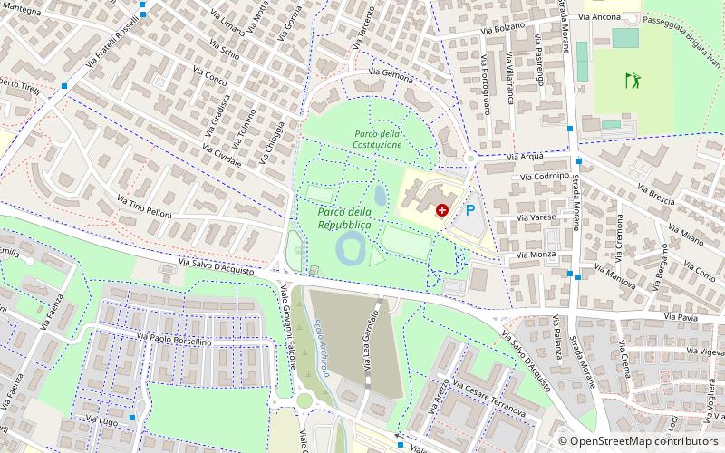
Parco della Repubblica is a place located in Modena (Emilia-Romagna region) and belongs to the category of relax in park, park.
It is situated at an altitude of 128 feet, and its geographical coordinates are 44°37'33"N latitude and 10°55'20"E longitude.
Planning a visit to this place, one can easily and conveniently get there by public transportation. Parco della Repubblica is a short distance from the following public transport stations: Morane bv Pavia (bus, 7 min walk), Chinnici (trolleybus, 9 min walk), Modena Piazza Manzoni (train, 20 min walk).
Among other places and attractions worth visiting in the area are: Centro commerciale "La Rotonda" (shopping, 12 min walk), San Pietro Church (church, 30 min walk), Centro commerciale I Gelsi (shopping, 31 min walk).
Modena
- Bus
- Trolleybus
- Train
 Bus
Bus
- Calculate routeMorane bv Pavia 7 min walk
- Calculate routeMattarella 7 min walk
- Calculate routeMorane Hesperia 7 min walk
- Calculate routeChinnici 9 min walk
- Calculate routeRosselli villa Rosa 11 min walk
- Calculate routeModena Piazza Manzoni 20 min walk
- Calculate routeModena Policlinico 29 min walk


Frequently Asked Questions (FAQ)
How to get to Parco della Repubblica by public transport?
Bus
- Morane bv Pavia • Lines: 5, 5A (7 min walk)
- Mattarella • Lines: 3 (7 min walk)
Trolleybus
- Chinnici • Lines: 6 (9 min walk)
- Rosselli villa Rosa • Lines: 6 (11 min walk)
Train
- Modena Piazza Manzoni (20 min walk)
- Modena Policlinico (29 min walk)