Porta Cavalleggeri, Rome
Map
Facts and practical information
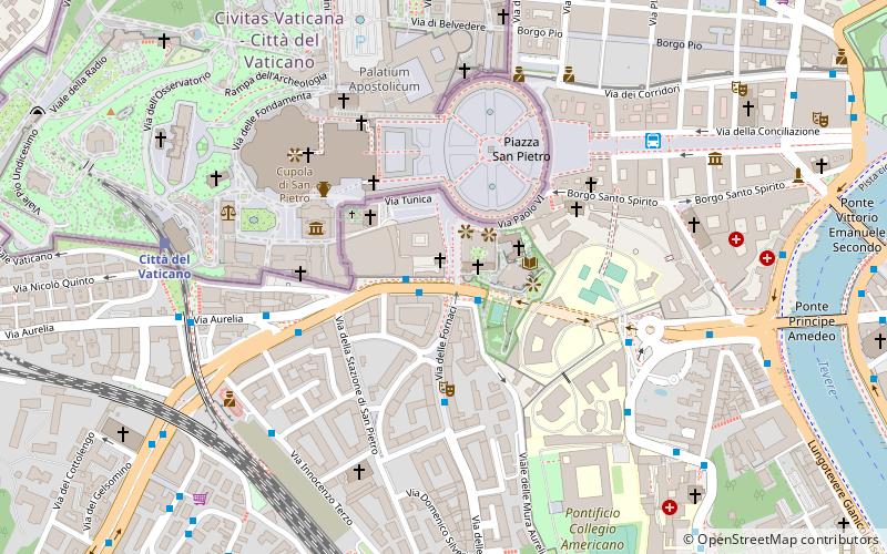
Porta Cavalleggeri was one of the gates of the Leonine Wall in Rome. ()
Address
Stato della Città del VaticanoRome
ContactAdd
Social media
Add
Getting there by public transportation
Public transportation stops near this location
- Metro
- Bus
- Tram
- Light rail
- Train
- Ferry
 Metro
Metro
- Calculate routeCavalleggeri/S. Pietro 1 min walk
- Calculate routeCavalleggeri/Fornaci 2 min walk
- Calculate routeFornaci 4 min walk
- Calculate routeCavalleggeri/Gregorio VII 4 min walk
- Calculate routeVatican City 8 min walk
- Calculate routeRoma San Pietro 8 min walk
- Calculate routeValle Aurelia 20 min walk
- Calculate routeAppiano 31 min walk
- Calculate routeRisorgimento/S. Pietro 11 min walk
- Calculate routeOttaviano 17 min walk
- Calculate routeMilizie/Distretto Militare 22 min walk
- Calculate routeSant'Angelo 16 min walk
- Calculate routePonte Cavour 25 min walk
- Calculate routeIsola Tiberina 32 min walk
- Calculate routeOttaviano 17 min walk
- Calculate routeCipro 17 min walk
- Calculate routeValle Aurelia 21 min walk
- Calculate routeLepanto 24 min walk
- Calculate routeFlaminio 35 min walk
Maps Metro / Tram / Rail
Metro / Tram / RailDay trips


Frequently Asked Questions (FAQ)
Which popular attractions are close to Porta Cavalleggeri?
Nearby attractions include Palace of the Holy Office, Rome (2 min walk), Pietà, Rome (3 min walk), Teutonic Cemetery, Rome (3 min walk), Vatican Christmas Tree, Rome (4 min walk).
How to get to Porta Cavalleggeri by public transport?
The nearest stations to Porta Cavalleggeri:
Bus
Train
Tram
Ferry
Metro
Light rail
Bus
- Cavalleggeri/S. Pietro • Lines: 190F, 34, 46, 64, 881, 916, 916F, 98, 982, n15, n20, n5 (1 min walk)
- Cavalleggeri/Fornaci • Lines: 64 (2 min walk)
Train
- Vatican City (8 min walk)
- Roma San Pietro (8 min walk)
Tram
- Risorgimento/S. Pietro • Lines: 19 (11 min walk)
- Ottaviano • Lines: 19 (17 min walk)
Ferry
- Sant'Angelo • Lines: Battelli di Roma (16 min walk)
- Ponte Cavour (25 min walk)
Metro
- Ottaviano • Lines: A (17 min walk)
- Cipro • Lines: A (17 min walk)
Light rail
- Flaminio • Lines: Fc3 (35 min walk)