Planura Hut
#1007 among destinations in Switzerland
![Planura Hut location map](https://tzmedia.b-cdn.net/media/images/static-maps/ch/46_82_8_88056.jpg)
Facts and practical information
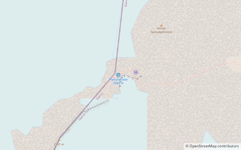
The Planura Hut is a mountain hut of the Swiss Alpine Club, located on the border between the cantons of Uri and Glarus, between Amsteg and Linthal. It lies at a height of 2,947 metres above sea level, on the watershed between the Hüfi Glacier and the Sandfirn. ()
GlarusSwitzerland
Planura Hut – popular in the area (distance from the attraction)
Nearby attractions include: Tödi, Clariden, Gemsfairenstock, Bifertenstock.
1.7 miENature, Natural attraction, MountainTödi
45 min walk • The Tödi, is a mountain massif and with the mountain peak Piz Russein the highest mountain in the Glarus Alps and the highest summit in the canton of Glarus, Switzerland.
1.6 miNNature, Natural attraction, MountainClariden
41 min walk • The Clariden is a mountain in the Glarus Alps, located at an elevation of 3,267 m between the Swiss cantons of Uri and Glarus. While on the north the Clariden overlooks the 1,948 m high Klausen Pass, the south side is covered by large glaciers.
3.3 miNENature, Natural attraction, MountainGemsfairenstock
85 min walk • The Gemsfairenstock is a mountain of the Glarus Alps, located on the border between the Swiss cantons of Uri and Glarus. It lies east of the Klausen Pass, on the range east of the Clariden. A trail leads to its summit via the western ridge.
3.8 miENature, Natural attraction, MountainBifertenstock
98 min walk • The Bifertenstock is a mountain in the Glarus Alps, located at an elevation of 3,419 m on the border between the cantons of Glarus and Graubünden, its peak, however, is located about 25 metres south of the border.
2.5 miWNature, Natural attraction, MountainSchärhorn
64 min walk • The Schärhorn is a mountain in the Glarus Alps near Klausen Pass. The highest summit is named Gross Schärhorn while a second summit is named Chli Schärhorn.
3.6 miNNature, Natural attraction, Scenic drivesKlausen Pass, Altdorf
92 min walk • Klausen Pass is a high mountain pass in the Swiss Alps connecting Altdorf in the canton of Uri with Linthal in the canton of Glarus.
4.3 miNNature, Natural attraction, MountainGlatten Mountain
111 min walk • The Glatten is a mountain of the Schwyzer Alps, overlooking the Klausen Pass in the canton of Uri. It is the tripoint between the valleys Bisistal, Schächental and Urner Boden. The summit consists of a large karstic plateau.
3.2 miSWNature, Natural attraction, MountainDüssi
81 min walk • The Düssi is a mountain in the Glarus Alps in central Switzerland, located on the border between the cantons of Uri and Graubünden. Its massif separates the valleys of Maderanertal and Val Russein. The summit is also named Gross Düssi to distinguish it from a lower summit to the south named Chli Düssi.
5 miWNature, Natural attraction, MountainGross Ruchen
129 min walk • The Gross Ruchen is a mountain in the Glarus Alps, overlooking the Brunnital south of Unterschächen in the canton of Uri. It is located between the higher Gross Windgallen on the west and the Chli Ruchen on the east.
4.6 miENature, Natural attraction, MountainSelbsanft
118 min walk • The Selbsanft is a mountain massif in the Glarus Alps, overlooking the village of Linthal in the canton of Glarus. The Selbsanft is a large mountain massif consisting of several summits of which the highest is named Hideri Schibe.
6.3 miNWNature, Natural attraction, MountainSchächentaler Windgällen
161 min walk • The Schächentaler Windgällen is a mountain massif in the Schwyzer Alps, overlooking Unterschächen in the canton of Uri. The two named peaks are Höch Windgällen and Läged Windgällen. The mountain massif lies between the valley of Muotathal and Schächental. The Schächentaler Windgällen are located a few kilometres west of Klausen Pass.