Botany, Sydney
Map
Facts and practical information
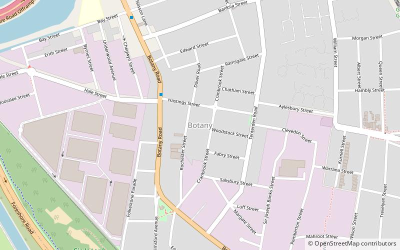
Botany Post Office is a heritage-listed post office at 2 Banksia Street, Botany, Sydney, New South Wales, Australia. It was added to the Australian Commonwealth Heritage List on 8 November 2011. ()
Coordinates: 33°56'52"S, 151°11'57"E
Address
Eastern Suburbs (Botany)Sydney
ContactAdd
Social media
Add
Getting there by public transportation
Public transportation stops near this location
- Train
 Train
Train
- Calculate routeDomestic Airport 36 min walk
Maps Sydney TrainsMaps
 Sydney Light RailMaps
 Sydney Ferries
Sydney TrainsMapsSydney Light RailMapsSydney FerriesDay trips


Frequently Asked Questions (FAQ)
How to get to Botany by public transport?
The nearest stations to Botany:
Train
Train
- Domestic Airport (36 min walk)