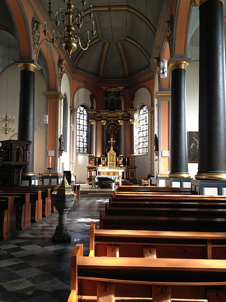
St. Katharina, Aachen

Gallery (2)
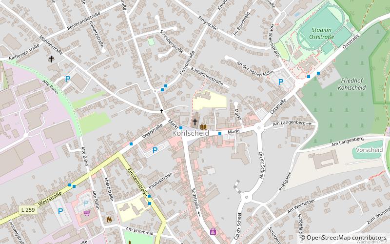
Map
Map
Gallery
Facts and practical information
The Catholic parish church of St. Catherine is a listed church building in Kohlscheid, a district of Herzogenrath in the Aachen city region.
Architectural style: NeoclassicismCoordinates: 50°50'6"N, 6°5'20"E
Getting there by public transportation
Public transportation stops near this location
- Bus
- Train
 Bus
Bus
- Calculate routeKohlscheid Markt 2 min walk
- Calculate routeNordstraße 3 min walk
- Calculate routeKohlscheid Alte Post 5 min walk
- Calculate routeKohlscheid 17 min walk
Day trips


Frequently Asked Questions (FAQ)
How to get to St. Katharina by public transport?
The nearest stations to St. Katharina:
Bus
Train
Bus
- Kohlscheid Markt • Lines: 34, 54, 80, Hz 2, N 3, N 6, Wü 1 (2 min walk)
- Nordstraße • Lines: 54, 80, N 3, N 6 (3 min walk)
Train
- Kohlscheid (17 min walk)