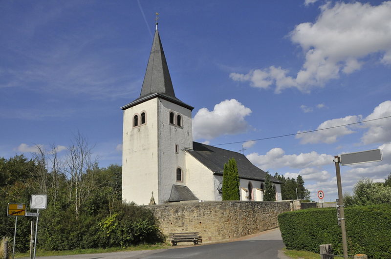
St. Cyriakus

Gallery (4)
Map

Map
Gallery
Facts and practical information
The Catholic parish church of St. Cyriacus in Weyer, a district of the municipality of Mechernich in the district of Euskirchen in the south of North Rhine-Westphalia, was first mentioned around 1187 as a church incorporated into the monastery of Steinfeld.
The church dedicated to St. Cyriac is a protected monument and was located above a Frankish burial ground. It is located on a hill on the outskirts of the village in the middle of a walled cemetery.
Coordinates: 50°32'33"N, 6°39'2"E
Day trips